|
search place name
|
||
Papp-puszta (Tolna, Hungary)Papp-puszta is a town in the Tolna region of Hungary. An overview map of the region around Papp-puszta is displayed below.
regional and 3d topo map of Papp-puszta, Hungary ::

Papp-puszta airports ::
The nearest airport is BUD - Budapest Ferihegy, located 104.4 km north of Papp-puszta.
Other airports nearby include OSI - Osijek (119.1 km south), BEG - Beograd (220.6 km south east), BTS - Bratislava M R Stefanik (221.5 km north west), Nearby towns ::
Máriamajor (2.2km south west) //
Magyaripuszta (3.7km north) //
Meszesidunapart (2.5km east) //
Gerjen (3.9km south) //
Foktő (3.2km south east) //
Uszóditanyák (4.5km north east) //
Uszód (4.5km north east) //
Ötvöstanya (3.8km west) //
Dunaszentgyörgy (3.8km west) //
Lajosmajor (5.7km south) //
Jánosmajor (5.7km south) //
Gebhardtpuszta (6.1km south east) //
Dunaszentbenedek (7.5km north) //
Csámpa (6.7km north west) //
Kovácsmajor (7.8km south) //
Györgymajor (7.8km south) //
Fadd (8.3km south west) //
Bátya (7.5km south east) //
Felsőszállások (7.5km south east) //
Negyven (7.5km south east) //
Partalja (9.0km south west) //
Alsószállások (9.0km south east) //
[all distances 'as the bird flies' and approximate] 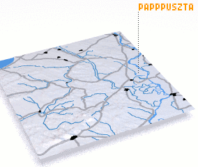
Disclaimer :: Information on this page comes without warranty of any kind |
||
|
Where is Papp-puszta? Elevation and coordinates ::
Latitude (lat): 46°32'0"N Longitude (lon): 18°53'0"E
Elevation (approx.): 87m (map arrows pan, magnifying glasses zoom) |
||
|
Visiting Papp-puszta? Hotel/Accommodation ::
Book a hotel in Papp-puszta Travel Guide ::
Buy a travel guide for Hungary rental cars ::
car rental offers GPS waypoint ::
download a GPX waypoint (PoI) of Papp-puszta for your GPS receiver
|
||