|
search place name
|
||
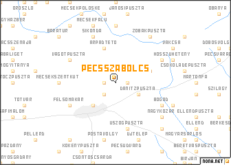
Pécsszabolcs (Pécs, Hungary)Pécsszabolcs is a town in the Pécs region of Hungary. An overview map of the region around Pécsszabolcs is displayed below.
regional and 3d topo map of Pécsszabolcs, Hungary ::
Pécsszabolcs airports ::
The nearest airport is OSI - Osijek, located 84.1 km south east of Pécsszabolcs.
Other airports nearby include BUD - Budapest Ferihegy (165.1 km north east), VIE - Vienna Schwechat (256.3 km north west), Nearby towns ::
Lámpásvölgy (1.3km east) //
Alsógyükés (1.3km east) //
Nagybányarétivölgy (1.3km east) //
Basamalom (1.3km east) //
Rückerakna (1.3km east) //
Csertető (1.3km east) //
Rigódertető (1.3km east) //
Felsőtelep (1.3km east) //
Felsőgyükés (1.3km east) //
Györgytelep (1.3km east) //
Istvánakna (1.3km east) //
Pécsbánya (1.3km west) //
Borbálatelep (2.3km south west) //
Danitzpuszta (3.2km south east) //
Pécs (4.5km south west) //
Ligettelep (4.3km north east) //
Árpádtető (5.7km north) //
Mánfa (5.7km north) //
Malomhegy (5.7km north) //
Vágat (5.7km north) //
Üszögpuszta (7.5km south) //
Hársastelep (6.3km north east) //
Sikonda (7.8km north) //
Zsemenye (6.3km south east) //
Bogád (6.3km south east) //
Vágotpuszta (6.3km north west) //
Czupytelep (6.3km south west) //
Csoronika (6.3km south west) //
Szkókó (6.3km south west) //
[all distances 'as the bird flies' and approximate]  Places with similar names to Pécsszabolcs, Hungary :: Disclaimer :: Information on this page comes without warranty of any kind |
||
|
Where is Pécsszabolcs? Elevation and coordinates ::
Latitude (lat): 46°7'0"N Longitude (lon): 18°16'0"E
Elevation (approx.): 260m (map arrows pan, magnifying glasses zoom) |
||
|
Visiting Pécsszabolcs? Hotel/Accommodation ::
Book a hotel in Pécsszabolcs Travel Guide ::
Buy a travel guide for Hungary rental cars ::
car rental offers GPS waypoint ::
download a GPX waypoint (PoI) of Pécsszabolcs for your GPS receiver
|
||