|
search place name
|
||
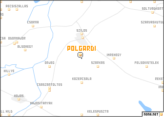
Polgárdi (Bács-Kiskun, Hungary)Polgárdi is a town in the Bács-Kiskun region of Hungary. An overview map of the region around Polgárdi is displayed below.
regional and 3d topo map of Polgárdi, Hungary ::
Polgárdi airports ::
The nearest airport is BUD - Budapest Ferihegy, located 106.0 km north of Polgárdi.
Other airports nearby include OSI - Osijek (118.5 km south), BEG - Beograd (202.6 km south east), Nearby towns ::
Szarkás (3.2km south east) //
Kecel (4.7km north) //
Középcsala (5.6km south) //
Szilos (5.6km north) //
Bekó (5.6km north) //
Felsőtanyák (5.6km north) //
Hosszúlapos (5.6km north) //
Alsótanyák (5.6km north) //
Imrehegy (5.1km east) //
Őrjeg (5.4km west) //
Császártöltés (8.5km south west) //
Keceli Úti Tanyák (9.0km south west) //
[all distances 'as the bird flies' and approximate] 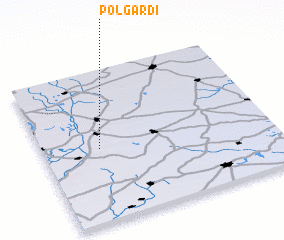 Places with similar names to Polgárdi, Hungary ::
// Polgárdi (HU)
// Palo Gordo (CU)
// Polk Road (US)
// Palo Gordo (CO)
// Palogordo (CO)
// Palogordo (CO)
// Polokarto (ID)
// Pulo Kruet (ID)
// Paligrad (MK)
// Palo Gordo (MX)
Disclaimer :: Information on this page comes without warranty of any kind |
||
|
Where is Polgárdi? Elevation and coordinates ::
Latitude (lat): 46°29'0"N Longitude (lon): 19°15'0"E
Elevation (approx.): 107m (map arrows pan, magnifying glasses zoom) |
||
|
Visiting Polgárdi? Hotel/Accommodation ::
Book a hotel in Polgárdi Travel Guide ::
Buy a travel guide for Hungary rental cars ::
car rental offers GPS waypoint ::
download a GPX waypoint (PoI) of Polgárdi for your GPS receiver
|
||