|
search place name
|
||
Rákóczikert (Hajdú-Bihar, Hungary)Rákóczikert is a town in the Hajdú-Bihar region of Hungary. An overview map of the region around Rákóczikert is displayed below.
regional and 3d topo map of Rákóczikert, Hungary ::

Rákóczikert airports ::
The nearest airport is DEB - Debrecen, located 39.3 km south of Rákóczikert.
Other airports nearby include KSC - Kosice (94.2 km north), OMR - Oradea (94.8 km south), SUJ - Satu Mare (104.9 km east), BAY - Baia Mare Tautii Magheraus (149.0 km east), Nearby towns ::
Hajdúdorog (1.9km south) //
Csontoskert (1.9km south) //
Disznókút Észak (2.5km east) //
Disznókút Kelet (2.5km east) //
Disznókút Nyugat (2.5km east) //
Kölesföld (3.9km south) //
Lókert (4.5km south east) //
Zajgatódůlő (4.2km south west) //
Zajgatódůlő (4.2km south west) //
Niczkyrét (5.3km west) //
Lopóhalomjárás (5.3km west) //
Hajdúnánás (5.3km west) //
Tedej (5.3km west) //
Görögkút Dél (6.7km north east) //
Gyúlás (7.5km south east) //
Nagylapos (8.9km north east) //
[all distances 'as the bird flies' and approximate] 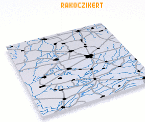 Places with similar names to Rákóczikert, Hungary ::
// Rákóczikert (HU)
Disclaimer :: Information on this page comes without warranty of any kind |
||
|
Where is Rákóczikert? Elevation and coordinates ::
Latitude (lat): 47°50'0"N Longitude (lon): 21°30'0"E
Elevation (approx.): 103m (map arrows pan, magnifying glasses zoom) |
||
|
Visiting Rákóczikert? Hotel/Accommodation ::
Book a hotel in Rákóczikert Travel Guide ::
Buy a travel guide for Hungary rental cars ::
car rental offers GPS waypoint ::
download a GPX waypoint (PoI) of Rákóczikert for your GPS receiver
|
||