|
search place name
|
||
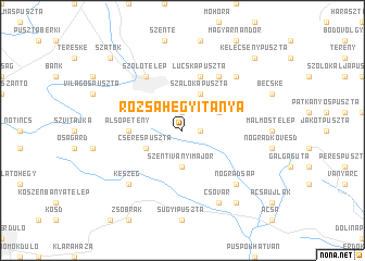
Rózsahegyitanya (Nógrád, Hungary)Rózsahegyitanya is a town in the Nógrád region of Hungary. An overview map of the region around Rózsahegyitanya is displayed below.
regional and 3d topo map of Rózsahegyitanya, Hungary ::
Rózsahegyitanya airports ::
The nearest airport is BUD - Budapest Ferihegy, located 49.7 km south of Rózsahegyitanya.
Other airports nearby include SLD - Sliac (84.8 km north), PZY - Piestany (136.9 km north west), TAT - Poprad Tatry (149.5 km north east), KSC - Kosice (168.2 km north east), Nearby towns ::
Legénd (1.2km east) //
Káldytanya (1.2km east) //
Szupukatanya (1.9km north) //
Szentiványimajor (3.7km south) //
Nézsa (3.7km south) //
Cserespuszta (3.1km south west) //
Szécsénke (3.1km north east) //
Szalókapuszta (3.9km north) //
Alsópetény (3.7km west) //
Lucskapuszta (5.7km north) //
Kisecset (5.7km north) //
Ilonapuszta (6.1km north east) //
Romhány (6.1km north west) //
Szőlőtelep (6.1km north west) //
Nógrádsáp (6.7km south east) //
Keszeg (6.7km south west) //
Epresmajor (6.7km north east) //
Csővár (7.8km south) //
Klokocsimajor (8.3km south east) //
Szátok (8.9km north west) //
Kelecsénypuszta (8.9km north east) //
[all distances 'as the bird flies' and approximate] 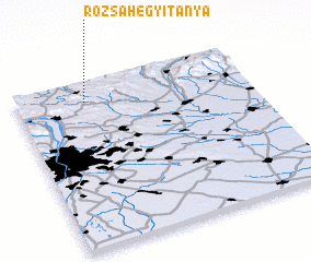 Places with similar names to Rózsahegyitanya, Hungary :: Disclaimer :: Information on this page comes without warranty of any kind |
||
|
Where is Rózsahegyitanya? Elevation and coordinates ::
Latitude (lat): 47°53'0"N Longitude (lon): 19°18'0"E
Elevation (approx.): 222m (map arrows pan, magnifying glasses zoom) |
||
|
Visiting Rózsahegyitanya? Hotel/Accommodation ::
Book a hotel in Rózsahegyitanya Travel Guide ::
Buy a travel guide for Hungary rental cars ::
car rental offers GPS waypoint ::
download a GPX waypoint (PoI) of Rózsahegyitanya for your GPS receiver
|
||