|
search place name
|
||
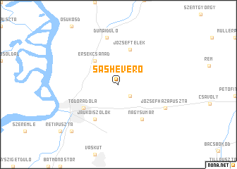
Sasheverő (Bács-Kiskun, Hungary)Sasheverő is a town in the Bács-Kiskun region of Hungary. An overview map of the region around Sasheverő is displayed below.
regional and 3d topo map of Sasheverő, Hungary ::
Sasheverő airports ::
The nearest airport is OSI - Osijek, located 85.3 km south of Sasheverő.
Other airports nearby include BUD - Budapest Ferihegy (136.9 km north), BEG - Beograd (185.3 km south east), BTS - Bratislava M R Stefanik (256.6 km north west), Nearby towns ::
Mártonszállás (2.3km south east) //
Érsekcsanád (4.5km north west) //
Józseftelek (5.7km north) //
Nagysumár (6.1km south east) //
Felsőjárás (5.3km south west) //
Felsőszőlők (5.3km south west) //
Jaukóiszőlők (6.1km south west) //
Kenderesiszőlők (5.3km south west) //
Láp (5.3km south west) //
Mátéháza (5.3km south west) //
Nagylapos (5.3km south west) //
Aligvárda (5.3km south west) //
Alsójárás (5.3km south west) //
Alsóvrányos (5.3km south west) //
Babinadola (5.3km south west) //
Baja (5.3km south west) //
Öregszőlők (5.3km south west) //
Ötvenéveserdő (5.3km south west) //
Régialigvárda (5.3km south west) //
Szentgyörgy (5.3km south west) //
Todoradola (5.3km south west) //
Dunapart (7.5km north) //
Sükösd (7.5km north) //
Dunaidůlő (7.5km north) //
Józsefházapuszta (6.3km south east) //
Petői Szőlők (9.0km south west) //
[all distances 'as the bird flies' and approximate] 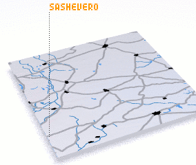 Places with similar names to Sasheverő, Hungary :: Disclaimer :: Information on this page comes without warranty of any kind |
||
|
Where is Sasheverő? Elevation and coordinates ::
Latitude (lat): 46°13'0"N Longitude (lon): 19°1'0"E
Elevation (approx.): 117m (map arrows pan, magnifying glasses zoom) |
||
|
Visiting Sasheverő? Hotel/Accommodation ::
Book a hotel in Sasheverő Travel Guide ::
Buy a travel guide for Hungary rental cars ::
car rental offers GPS waypoint ::
download a GPX waypoint (PoI) of Sasheverő for your GPS receiver
|
||