|
search place name
|
||
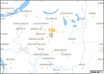
Tag (Bács-Kiskun, Hungary)Tag is a town in the Bács-Kiskun region of Hungary. An overview map of the region around Tag is displayed below.
regional and 3d topo map of Tag, Hungary ::
Tag airports ::
The nearest airport is BUD - Budapest Ferihegy, located 97.6 km north of Tag.
Other airports nearby include OSI - Osijek (124.5 km south), BEG - Beograd (216.5 km south east), BTS - Bratislava M R Stefanik (227.5 km north west), Nearby towns ::
Külsőcsorna (0.0km north) //
Kistény (1.3km west) //
Alsóerek (1.9km north) //
Szakmár (1.8km south west) //
Ludasszállás (2.2km north east) //
Öregtény (2.5km west) //
Andrásszállás (3.7km north) //
Újtelek (3.2km north west) //
Pécsiszállás (3.2km north east) //
Szeliditópart (4.5km north west) //
Mácsa (5.6km south) //
Felsőerek (5.6km north) //
Gombolyag (4.2km north west) //
Vörösszállás (4.2km south west) //
Öregcsertő (6.3km south) //
Halom (6.1km south west) //
Ödönmajor (6.1km south east) //
Negyvenszállás (5.3km south west) //
Csorna (5.4km east) //
Kiskecskemégy (7.8km south) //
Homokmégy (8.9km south) //
Szentkirály (8.3km north east) //
Alsójárás (8.3km north west) //
Alsómégy (8.3km south east) //
[all distances 'as the bird flies' and approximate] 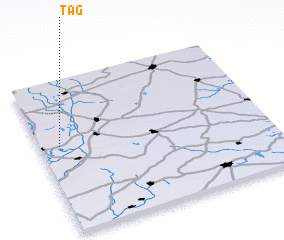 Places with similar names to Tag, Hungary ::
Disclaimer :: Information on this page comes without warranty of any kind |
||
|
Where is Tag? Elevation and coordinates ::
Latitude (lat): 46°34'0"N Longitude (lon): 19°5'0"E
Elevation (approx.): 89m (map arrows pan, magnifying glasses zoom) |
||
|
Visiting Tag? Hotel/Accommodation ::
Book a hotel in Tag Travel Guide ::
Buy a travel guide for Hungary rental cars ::
car rental offers GPS waypoint ::
download a GPX waypoint (PoI) of Tag for your GPS receiver
|
||