|
search place name
|
||
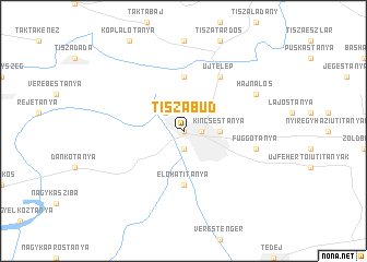
Tiszabůd (Szabolcs-Szatmár-Bereg, Hungary)Tiszabůd is a town in the Szabolcs-Szatmár-Bereg region of Hungary. An overview map of the region around Tiszabůd is displayed below.
regional and 3d topo map of Tiszabůd, Hungary ::
Tiszabůd airports ::
The nearest airport is DEB - Debrecen, located 56.7 km south of Tiszabůd.
Other airports nearby include KSC - Kosice (77.9 km north), OMR - Oradea (112.6 km south), SUJ - Satu Mare (118.6 km east), TAT - Poprad Tatry (147.9 km north west), Nearby towns ::
Tiszavasvári (0.0km north) //
Előháttanyák (1.9km south) //
Dorog Úti Tanyák (1.2km east) //
Szorgalmatos (1.2km east) //
Bůdszentmihály (1.2km east) //
Ónoditanya (2.2km north west) //
Kincsestanya (2.5km east) //
Előhátitanya (5.6km south) //
Rázompuszta (5.6km north) //
Tiszalök (6.1km north east) //
Újtelep (6.1km north east) //
Függőtanya (5.3km east) //
Hajnalos (6.2km north east) //
[all distances 'as the bird flies' and approximate] 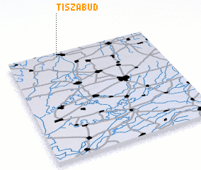 Places with similar names to Tiszabůd, Hungary :: Disclaimer :: Information on this page comes without warranty of any kind |
||
|
Where is Tiszabůd? Elevation and coordinates ::
Latitude (lat): 47°58'0"N Longitude (lon): 21°21'0"E
Elevation (approx.): 92m (map arrows pan, magnifying glasses zoom) |
||
|
Visiting Tiszabůd? Hotel/Accommodation ::
Book a hotel in Tiszabůd Travel Guide ::
Buy a travel guide for Hungary rental cars ::
car rental offers GPS waypoint ::
download a GPX waypoint (PoI) of Tiszabůd for your GPS receiver
|
||