|
search place name
|
||
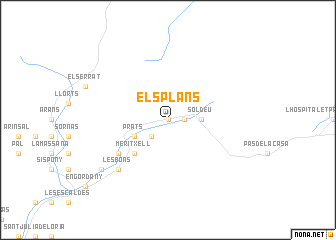
Els Plans (Andorra)Els Plans is a town in Andorra. An overview map of the region around Els Plans is displayed below.
regional and 3d topo map of Els Plans, Andorra ::
Els Plans airports ::
The nearest airport is LEU - Seo De Urgel, located 32.8 km south west of Els Plans.
Other airports nearby include CCF - Carcassonne Salvaza (89.2 km north east), LRH - La Rochelle Lherm (100.8 km north), PGF - Perpignan Rivesaltes (102.9 km east), TLS - Toulouse Blagnac (118.2 km north), Nearby towns ::
La Costa (0.0km north) //
Ransol (0.0km north) //
LʼAldosa (0.0km north) //
Sant Pere (1.4km east) //
El Tarter (1.4km east) //
Sant Joan de Caselles (2.3km south west) //
Soldeu (2.7km east) //
Canillo (3.3km south west) //
El Vilar (3.3km south west) //
Prats (3.3km south west) //
Meritxell (4.6km south west) //
El Tremat (5.5km south west) //
Molleres (5.5km south west) //
Mosquera (5.5km south west) //
Les Bons (6.9km south west) //
Encamp (6.9km south west) //
Vila (7.8km south west) //
[all distances 'as the bird flies' and approximate] 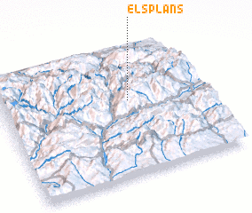 Places with similar names to Els Plans, Andorra :: Disclaimer :: Information on this page comes without warranty of any kind |
||
|
Where is Els Plans? Elevation and coordinates ::
Latitude (lat): 42°35'0"N Longitude (lon): 1°38'0"E
Elevation (approx.): 1856m (map arrows pan, magnifying glasses zoom) |
||
|
Visiting Els Plans? Hotel/Accommodation ::
Book a hotel in Els Plans Travel Guide ::
Buy a travel guide for Andorra rental cars ::
car rental offers GPS waypoint ::
download a GPX waypoint (PoI) of Els Plans for your GPS receiver
|
||