|
search place name
|
||
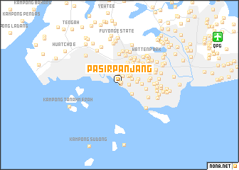
Pasir Panjang (Singapore)Pasir Panjang is a town in Singapore. An overview map of the region around Pasir Panjang is displayed below.
regional and 3d topo map of Pasir Panjang, Singapore ::
Pasir Panjang airports ::
The nearest airport is QPG - Paya Lebar, located 17.2 km north east of Pasir Panjang.
Other airports nearby include XSP - Singapore Seletar (17.5 km north east), SIN - Singapore Changi Intl (25.7 km east), JHB - Johor Bahru Sultan Ismail (40.2 km north), MKZ - Malacca (200.2 km north west), Nearby towns ::
Island View Estate (0.3km north east) //
Prince Edward Park (0.5km north east) //
Kent Ridge (1.5km east) //
Medway Park (1.5km north) //
Sussex Estate (1.8km north) //
Ayer Raja New Town (1.9km north east) //
Nepal Park (2.2km north east) //
Rochester Park (2.3km north east) //
Buona Vista (2.3km south east) //
Tua Kang Lye (2.5km north) //
Holland Grove Park (2.5km north east) //
Clementi New Town (2.7km north) //
Wessex Estate (2.8km east) //
Ghim Moh (2.8km north east) //
McMahon Park (2.9km north east) //
Pandan Valley (2.9km north) //
Tanglin Halt (3.1km east) //
Holland Village (3.3km north east) //
Faber Hills (3.4km north) //
Hong Leong Garden (3.5km north west) //
Queenstown Estate (3.5km east) //
Maryland Estate (3.5km north east) //
Oei Tiong Ham Park (3.6km north east) //
Chinese Gardens (3.6km north east) //
Queen Astrid Park (3.7km north east) //
Leedon Park (3.7km north east) //
Ewart Park (3.8km north) //
Ban Guan Park (4.0km north east) //
Brickworks Estate (4.2km east) //
[all distances 'as the bird flies' and approximate]  Places with similar names to Pasir Panjang, Singapore ::
// Pasir Panjang (MY)
// Pasirpanjang (ID)
// Pasirpanjang (ID)
// Pasirpanjang (ID)
// Pasirpanjang (ID)
// Pasirpanjang (ID)
Disclaimer :: Information on this page comes without warranty of any kind |
||
|
Where is Pasir Panjang? Elevation and coordinates ::
Latitude (lat): 1°17'34"N Longitude (lon): 103°46'15"E
Elevation (approx.): 22m (map arrows pan, magnifying glasses zoom) |
||
|
Visiting Pasir Panjang? Hotel/Accommodation ::
Book a hotel in Pasir Panjang Travel Guide ::
Buy a travel guide for Singapore rental cars ::
car rental offers GPS waypoint ::
download a GPX waypoint (PoI) of Pasir Panjang for your GPS receiver
|
||