|
search place name
|
||
Ginteniai (Lithuania)Ginteniai is a town in Lithuania. An overview map of the region around Ginteniai is displayed below.
regional and 3d topo map of Ginteniai, Lithuania ::

Nearby towns ::
Upyna (4.2km north) //
Užberžynis (4.2km south east) //
Andrietiškiai (4.2km north east) //
Kirkliai (3.1km west) //
Kirkliukai (3.1km west) //
Užpelkiai (5.6km north) //
Degsnė (5.7km south) //
Vaišlaukis (5.9km south) //
Aunuvėnai (4.8km south east) //
Vidsodis (4.8km south east) //
Patumšiai (4.8km south west) //
Maudžiorai (5.9km south) //
Dubiniai (5.9km north) //
Girlaukė (4.5km north east) //
Verteliai (4.5km north west) //
Šeškiai (5.6km north east) //
Gaulėnai (5.6km south west) //
Minupiai (7.7km south) //
Moluvėnai (6.9km south west) //
Sauslaukė (8.5km north east) //
Žemalėnai (8.5km north west) //
[all distances 'as the bird flies' and approximate] 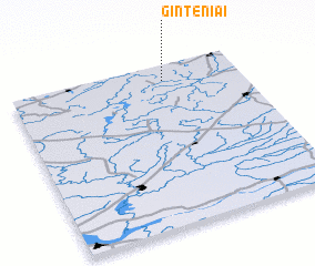 Places with similar names to Ginteniai, Lithuania ::
// Ginot-an (PH)
// Genėtiniai (LT)
// Genėtiniai (LT)
// John Town (US)
// Genntown (US)
// Johntown (US)
// Johntown (US)
// Gentan (ID)
// Gentan (ID)
// Jantaan (ID)
Disclaimer :: Information on this page comes without warranty of any kind |
||
|
Where is Ginteniai? Elevation and coordinates ::
Latitude (lat): 55°54'0"N Longitude (lon): 22°40'0"E
Elevation (approx.): 123m (map arrows pan, magnifying glasses zoom) |
||
|
Visiting Ginteniai? Hotel/Accommodation ::
Book a hotel in Ginteniai Travel Guide ::
Buy a travel guide for Lithuania rental cars ::
car rental offers GPS waypoint ::
download a GPX waypoint (PoI) of Ginteniai for your GPS receiver
|
||