|
search place name
|
||
Paalsys II (Lithuania)Paalsys II is a town in Lithuania. An overview map of the region around Paalsys II is displayed below.
regional and 3d topo map of Paalsys II, Lithuania ::

Nearby towns ::
Pauliai (1.1km east) //
Baužai (2.1km south west) //
Drebulynė (2.1km south west) //
Barzdžiai (2.3km east) //
Pantvardys II (3.9km south) //
Šapališkiai (4.3km north west) //
Pažėrai (3.7km south west) //
Skirsnemuniškiai Pirmieji (6.4km south) //
Paskynai (6.2km north) //
Panemunė (5.9km south) //
Dargiai (4.6km south west) //
Ažuolynė (6.4km south west) //
Vadžgirys (8.1km north) //
Skirsnemuniškiai II (7.7km south) //
Jurgeliškiai (5.6km south west) //
Naukaimis (7.7km south) //
Naukaimis (8.4km south) //
Šimkaičiai (6.5km north east) //
Bebirvyčiai (8.1km north east) //
[all distances 'as the bird flies' and approximate] 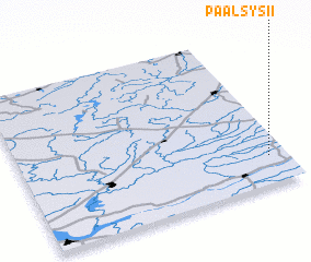 Places with similar names to Paalsys II, Lithuania ::
Disclaimer :: Information on this page comes without warranty of any kind |
||
|
Where is Paalsys II? Elevation and coordinates ::
Latitude (lat): 55°11'0"N Longitude (lon): 22°56'0"E
Elevation (approx.): 52m (map arrows pan, magnifying glasses zoom) |
||
|
Visiting Paalsys II? Hotel/Accommodation ::
Book a hotel in Paalsys II Travel Guide ::
Buy a travel guide for Lithuania rental cars ::
car rental offers GPS waypoint ::
download a GPX waypoint (PoI) of Paalsys II for your GPS receiver
|
||