|
search place name
|
||
Pagirgždūtė (Lithuania)Pagirgždūtė is a town in Lithuania. An overview map of the region around Pagirgždūtė is displayed below.
regional and 3d topo map of Pagirgždūtė, Lithuania ::

Pagirgždūtė airports ::
The nearest airport is KGD - Kaliningrad Khrabrovo, located 151.0 km south west of Pagirgždūtė.
Nearby towns ::
Užgiriai (1.9km north) //
Pagirgždūtis (1.0km west) //
Vašįlėnai (3.7km south) //
Rekščiai (3.9km north) //
Burbiškiai Didieji (2.8km north west) //
Valikiškė (2.8km south east) //
Kesai (2.8km south west) //
Veniai (4.3km north east) //
Žemieji Labūnai (3.1km east) //
Žvirgždžiai (5.7km north) //
Dvarviečiai (5.7km north) //
Aukštieji Labūnai (3.6km north east) //
Sendvariai (3.6km south east) //
Karklėnaliai (5.7km south) //
Mediškiai (5.9km north) //
Gaudkalnis (5.9km north) //
Ridikai (4.9km north west) //
Kumpelkė (4.9km south east) //
Ruška (5.9km south) //
Užkalniai (4.2km east) //
Pavandenė (7.5km north) //
Nevardėnai (4.6km south west) //
Pečiuliai (7.5km south) //
Ejučiai (6.4km south east) //
Kruopainiai (7.7km north) //
Pabiržulis Didysis (7.7km north) //
Karklėnai (5.6km south east) //
Severėnai (7.7km south) //
Daukantai (7.0km north west) //
[all distances 'as the bird flies' and approximate] 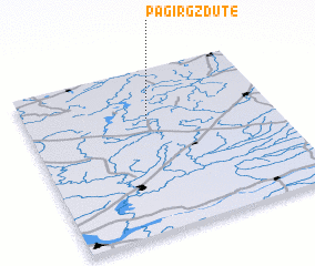 Places with similar names to Pagirgždūtė, Lithuania :: Disclaimer :: Information on this page comes without warranty of any kind |
||
|
Where is Pagirgždūtė? Elevation and coordinates ::
Latitude (lat): 55°42'0"N Longitude (lon): 22°30'0"E
Elevation (approx.): 186m (map arrows pan, magnifying glasses zoom) |
||
|
Visiting Pagirgždūtė? Hotel/Accommodation ::
Book a hotel in Pagirgždūtė Travel Guide ::
Buy a travel guide for Lithuania rental cars ::
car rental offers GPS waypoint ::
download a GPX waypoint (PoI) of Pagirgždūtė for your GPS receiver
|
||