|
search place name
|
||
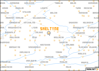
Šmėltynė (Lithuania)Šmėltynė is a town in Lithuania. An overview map of the region around Šmėltynė is displayed below.
regional and 3d topo map of Šmėltynė, Lithuania ::
Nearby towns ::
Žvirzdė (1.1km west) //
Vilnaliai (1.1km west) //
Paežeris (2.1km north east) //
Švendūna (2.1km south east) //
Nemakščiai (2.2km north east) //
Guikaliai (2.1km west) //
Žaliūkė (2.1km west) //
Legotiškė (2.1km east) //
Arglaičiai (2.8km south east) //
Mosteikiai (4.7km south) //
Užkalniai (4.8km north west) //
Lygiai (3.7km north west) //
Leonavičiai (5.7km south) //
Očiki (3.7km south west) //
Milžavėnai (6.7km north) //
Gelgudiškiai (5.9km north) //
Paupynis (5.9km south) //
Sugintai (4.9km south east) //
Lipkiškė (4.9km south east) //
Bokšeiniai (4.2km west) //
Taubučiai (6.1km south east) //
Balčiai (7.5km north) //
Daujotėliai (4.6km north west) //
Ižiniškiai (4.6km south east) //
Papušyniai (4.6km south west) //
Sniegoniškė (6.4km south west) //
Trakai (7.7km south) //
Kryžkalnis (5.6km north west) //
Vailabai (6.5km south east) //
[all distances 'as the bird flies' and approximate]  Places with similar names to Šmėltynė, Lithuania ::
// Sawmill Town (US)
// Smilden (NO)
// Smiltynai (LT)
// Smiltynė (LT)
// Smiltynė (LT)
// Smaltāni (LV)
// Smiltene (LV)
// Smiltiņi (LV)
// Cemalettin (TR)
// Cemalettin (TR)
Disclaimer :: Information on this page comes without warranty of any kind |
||
|
Where is Šmėltynė? Elevation and coordinates ::
Latitude (lat): 55°25'0"N Longitude (lon): 22°45'0"E
Elevation (approx.): 89m (map arrows pan, magnifying glasses zoom) |
||
|
Visiting Šmėltynė? Hotel/Accommodation ::
Book a hotel in Šmėltynė Travel Guide ::
Buy a travel guide for Lithuania rental cars ::
car rental offers GPS waypoint ::
download a GPX waypoint (PoI) of Šmėltynė for your GPS receiver
|
||