|
search place name
|
||
Užkalnupis (Lithuania)Užkalnupis is a town in Lithuania. An overview map of the region around Užkalnupis is displayed below.
regional and 3d topo map of Užkalnupis, Lithuania ::
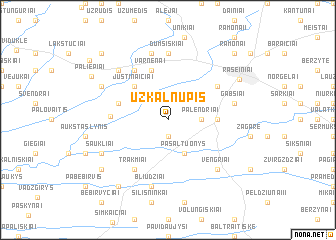
Nearby towns ::
Serbentai (1.9km south) //
Palendriai (2.1km east) //
Pašaltuonys (3.9km south) //
Justinaičiai (4.3km north west) //
Daumėnai (4.3km north west) //
Kalnujai (3.2km east) //
Slabada (5.7km north) //
Varnėnai (5.7km north) //
Ažuolynė (3.7km north west) //
Gervinė (3.7km west) //
Burgaičiai (5.9km north) //
Trakmiai (5.9km south) //
Stonai (4.9km north east) //
Dumšiškiai (7.4km north) //
Bliūdžiai (7.5km south) //
Gabšiai (4.6km north east) //
Aleksandrai (7.5km north) //
Naukaimis (6.4km north west) //
Vengriai (6.4km south east) //
Šaukliai (5.6km south west) //
Sujainiai (5.6km north west) //
Raseiniai (6.4km north east) //
Bebirvai (8.1km south west) //
Pleteriškė (7.0km south west) //
Paliepiai (6.9km north west) //
Ramonai (8.5km north east) //
Anžiliai (8.5km north west) //
Papelkiai (8.3km north west) //
[all distances 'as the bird flies' and approximate] 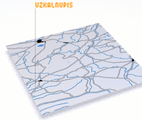 Places with similar names to Užkalnupis, Lithuania :: Disclaimer :: Information on this page comes without warranty of any kind |
||
|
Where is Užkalnupis? Elevation and coordinates ::
Latitude (lat): 55°20'0"N Longitude (lon): 23°3'0"E
Elevation (approx.): 66m (map arrows pan, magnifying glasses zoom) |
||
|
Visiting Užkalnupis? Hotel/Accommodation ::
Book a hotel in Užkalnupis Travel Guide ::
Buy a travel guide for Lithuania rental cars ::
car rental offers GPS waypoint ::
download a GPX waypoint (PoI) of Užkalnupis for your GPS receiver
|
||