|
search place name
|
||
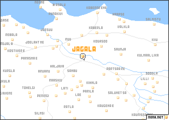
Jägala (Harjumaa, Estonia)Jägala is a town in the Harjumaa region of Estonia. An overview map of the region around Jägala is displayed below.
regional and 3d topo map of Jägala, Estonia ::
Jägala airports ::
The nearest airport is TLL - Tallinn-ulemiste International Tallinn, located 23.0 km west of Jägala.
Other airports nearby include HEM - Helsinki Malmi (93.9 km north), HEL - Helsinki Vantaa (101.4 km north), QVY - Utti (189.9 km north east), TMP - Tampere Pirkkala (240.0 km north), Nearby towns ::
Sambu (3.7km south) //
Kaersoo (4.7km south) //
Kodasoo (3.6km north east) //
Ruu (4.0km north west) //
Aavere (3.9km south east) //
Kääniku (5.5km north) //
Uusküla (5.6km south) //
Salumäe (6.0km south) //
Haljava (3.9km south west) //
Kihmla (6.3km south) //
Kaberla (6.2km north) //
Koila (4.4km north west) //
Vaase (6.8km south) //
Jägala-Joa (5.3km north west) //
Haavakannu (6.1km north east) //
Koogi (4.4km north west) //
Partsaare (4.7km south east) //
Parila (8.1km south) //
Saunja (4.3km east) //
Raasiku (6.5km south west) //
Anija (5.7km south east) //
Läti (7.8km south) //
Aruaru (5.8km south west) //
Jõesuu (7.0km north west) //
Linnakse (8.6km south) //
Valkla (7.8km north east) //
Salumetsa (9.2km south east) //
Kullamäe (9.7km north east) //
[all distances 'as the bird flies' and approximate] 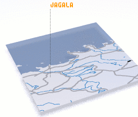 Places with similar names to Jägala, Estonia ::
Disclaimer :: Information on this page comes without warranty of any kind |
||
|
Where is Jägala? Elevation and coordinates ::
Latitude (lat): 59°25'2"N Longitude (lon): 25°14'19"E
Elevation (approx.): 44m (map arrows pan, magnifying glasses zoom) |
||
|
Visiting Jägala? Hotel/Accommodation ::
Book a hotel in Jägala Travel Guide ::
Buy a travel guide for Estonia rental cars ::
car rental offers GPS waypoint ::
download a GPX waypoint (PoI) of Jägala for your GPS receiver
|
||