|
search place name
|
||
Tagaküla (Võrumaa, Estonia)Tagaküla is a town in the Võrumaa region of Estonia. An overview map of the region around Tagaküla is displayed below.
regional and 3d topo map of Tagaküla, Estonia ::
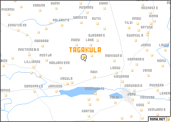
Nearby towns ::
Raiste (1.4km north east) //
Lahe (3.6km north) //
Roosi (3.7km north) //
Navi (3.7km south) //
Ojasaare (4.7km north) //
Soe (5.0km south) //
Mäe-Järvere (3.3km south west) //
Parksepa (3.3km east) //
Vagula (5.4km south west) //
Loosu (4.4km south east) //
Roosisaare (7.3km south) //
Mustajõe (7.4km north) //
Ala-Vagula (8.5km south) //
Sõreste (8.5km north) //
Mustja (4.5km west) //
Putki (8.3km north) //
Mäe-Vagula (8.6km south) //
Järvere (7.5km south west) //
Kirumpää (6.2km south east) //
Põlgaste (8.3km north) //
Magari (8.4km north west) //
Lauri (9.3km north west) //
[all distances 'as the bird flies' and approximate] 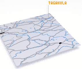 Places with similar names to Tagaküla, Estonia ::
Disclaimer :: Information on this page comes without warranty of any kind |
||
|
Where is Tagaküla? Elevation and coordinates ::
Latitude (lat): 57°54'34"N Longitude (lon): 26°55'36"E
Elevation (approx.): 90m (map arrows pan, magnifying glasses zoom) |
||
|
Visiting Tagaküla? Hotel/Accommodation ::
Book a hotel in Tagaküla Travel Guide ::
Buy a travel guide for Estonia rental cars ::
car rental offers GPS waypoint ::
download a GPX waypoint (PoI) of Tagaküla for your GPS receiver
|
||