|
search place name
|
||
Unametsa (Viljandimaa, Estonia)Unametsa is a town in the Viljandimaa region of Estonia. An overview map of the region around Unametsa is displayed below.
regional and 3d topo map of Unametsa, Estonia ::

Unametsa airports ::
The nearest airport is TLL - Tallinn-ulemiste International Tallinn, located 149.4 km north west of Unametsa.
Nearby towns ::
Soe (1.6km north) //
Kübeme (3.7km south) //
Järveküla (3.4km south east) //
Koguli (4.1km south west) //
Jakobimõisa (2.8km west) //
Kivilõppe (4.0km north east) //
Suislepa (5.7km south) //
Kaarli (5.8km north) //
Tarvastu (4.6km north west) //
Roosilla (6.1km south) //
Sooviku (5.5km north) //
Pikru (3.9km west) //
Uue-Suislepa (6.0km south east) //
Põra (7.1km south) //
Randa (6.3km south east) //
Porsa (6.0km north west) //
Mustla (5.4km north west) //
Vooru (8.1km south) //
Villa (7.6km north) //
Marjamäe (7.9km south) //
Maltsa (7.6km south east) //
Loime (8.7km south) //
Metsakuru (8.3km south west) //
Väikeküla (8.3km south west) //
Kalbuse (9.5km north) //
Reti (9.6km south west) //
[all distances 'as the bird flies' and approximate] 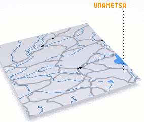 Places with similar names to Unametsa, Estonia :: Disclaimer :: Information on this page comes without warranty of any kind |
||
|
Where is Unametsa? Elevation and coordinates ::
Latitude (lat): 58°11'57"N Longitude (lon): 25°55'54"E
Elevation (approx.): 64m (map arrows pan, magnifying glasses zoom) |
||
|
Visiting Unametsa? Hotel/Accommodation ::
Book a hotel in Unametsa Travel Guide ::
Buy a travel guide for Estonia rental cars ::
car rental offers GPS waypoint ::
download a GPX waypoint (PoI) of Unametsa for your GPS receiver
|
||