|
search place name
|
||
Vennarti (Saaremaa, Estonia)Vennarti is a town in the Saaremaa region of Estonia. An overview map of the region around Vennarti is displayed below.
regional and 3d topo map of Vennarti, Estonia ::
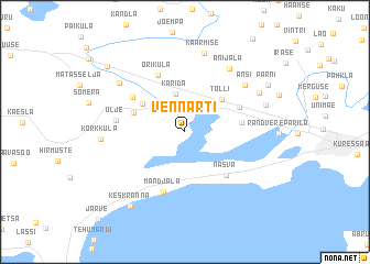
Nearby towns ::
Karida (3.9km north) //
Tõlli (3.9km north east) //
Paevere (3.6km north west) //
Kogula (3.3km north west) //
Mullutu (3.2km east) //
Tamsalu (3.8km north east) //
Nasva (4.9km south east) //
Paadla (4.5km north west) //
Oriküla (5.9km north) //
Mändjala (6.2km south) //
Ulje (3.8km west) //
Ansi (5.7km north east) //
Anijala (6.9km north) //
Kaarmise (8.0km north) //
Mõnnuste (6.0km north west) //
Randvere (5.6km north east) //
Kõrkküla (4.6km west) //
Viira (5.1km north east) //
Keskranna (8.1km south) //
Pärni (6.5km north east) //
Jõeküla (7.8km north west) //
Järve (10.0km south west) //
[all distances 'as the bird flies' and approximate] 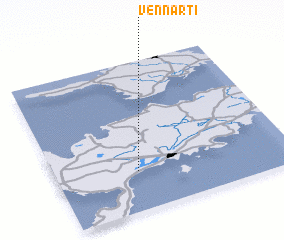 Places with similar names to Vennarti, Estonia ::
Disclaimer :: Information on this page comes without warranty of any kind |
||
|
Where is Vennarti? Elevation and coordinates ::
Latitude (lat): 58°16'7"N Longitude (lon): 22°20'50"E
Elevation (approx.): 10m (map arrows pan, magnifying glasses zoom) |
||
|
Visiting Vennarti? Hotel/Accommodation ::
Book a hotel in Vennarti Travel Guide ::
Buy a travel guide for Estonia rental cars ::
car rental offers GPS waypoint ::
download a GPX waypoint (PoI) of Vennarti for your GPS receiver
|
||