|
search place name
|
||
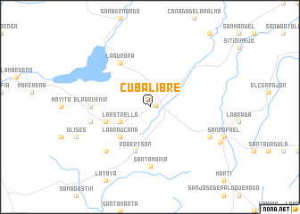
Cuba Libre (Camagüey, Cuba)Cuba Libre is a town in the Camagüey region of Cuba. An overview map of the region around Cuba Libre is displayed below.
regional and 3d topo map of Cuba Libre, Cuba ::
Cuba Libre airports ::
The nearest airport is CMW - Camaguey Ignacio Agramonte Intl, located 38.6 km north west of Cuba Libre.
Other airports nearby include VTU - Las Tunas Hermanos Ameijeiras (67.8 km south east), MZO - Manzanillo Sierra Maestra (114.4 km south east), BYM - Bayamo Carlos Manuel De Cespedes (132.7 km south east), HOG - Holguin Frank Pais Intl (136.0 km east), Nearby towns ::
Sibanicú (0.7km east) //
La Estrella (3.9km south west) //
La Araucana (5.1km south west) //
El Zanjón (5.5km west) //
Hatuey (5.8km south) //
Robertson (5.8km south) //
La Aurora (6.5km north west) //
Santa María (7.4km south) //
El Porvenir (6.9km west) //
El Tamarindo (7.2km west) //
Carmenates (7.6km south west) //
El Rosario (7.8km south east) //
Cascorro (9.3km south east) //
[all distances 'as the bird flies' and approximate] 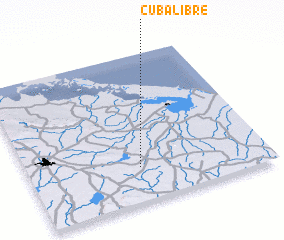 Places with similar names to Cuba Libre, Cuba ::
Disclaimer :: Information on this page comes without warranty of any kind |
||
|
Where is Cuba Libre? Elevation and coordinates ::
Latitude (lat): 21°14'0"N Longitude (lon): 77°32'0"W
Elevation (approx.): 94m (map arrows pan, magnifying glasses zoom) |
||
|
Visiting Cuba Libre? Hotel/Accommodation ::
Book a hotel in Cuba Libre Travel Guide ::
Buy a travel guide for Cuba rental cars ::
car rental offers GPS waypoint ::
download a GPX waypoint (PoI) of Cuba Libre for your GPS receiver
|
||