|
search place name
|
||
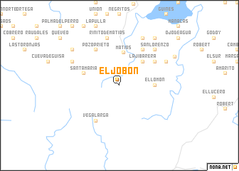
El Jobón (Santiago de Cuba, Cuba)El Jobón is a town in the Santiago de Cuba region of Cuba. An overview map of the region around El Jobón is displayed below.
regional and 3d topo map of El Jobón, Cuba ::
El Jobón airports ::
The nearest airport is BYM - Bayamo Carlos Manuel De Cespedes, located 43.2 km north west of El Jobón.
Other airports nearby include SCU - Santiago De Cuba Antonio Maceo Intl (54.6 km east), HOG - Holguin Frank Pais Intl (74.1 km north), MZO - Manzanillo Sierra Maestra (81.3 km west), VTU - Las Tunas Hermanos Ameijeiras (115.1 km north west), Nearby towns ::
Matías (5.2km north) //
La Jibarera (5.1km north east) //
El Saltón (5.1km north east) //
El Lomón (5.2km east) //
Santa María (5.5km west) //
El Punto (6.6km north east) //
Filé (6.4km north east) //
Pozo Prieto (6.6km north west) //
Vega Larga (6.6km south west) //
Rinito de Matías (7.6km north) //
San Lorenzo (7.6km north east) //
Los Gallegas (7.9km north east) //
Las Manantiales (8.2km north east) //
Buenavista (7.9km north west) //
Manaquita (9.1km north east) //
María Teresa (8.9km north west) //
Cruce de los Baños (9.3km north east) //
[all distances 'as the bird flies' and approximate] 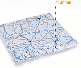 Places with similar names to El Jobón, Cuba ::
Disclaimer :: Information on this page comes without warranty of any kind |
||
|
Where is El Jobón? Elevation and coordinates ::
Latitude (lat): 20°7'0"N Longitude (lon): 76°20'0"W
Elevation (approx.): 350m (map arrows pan, magnifying glasses zoom) |
||
|
Visiting El Jobón? Hotel/Accommodation ::
Book a hotel in El Jobón Travel Guide ::
Buy a travel guide for Cuba rental cars ::
car rental offers GPS waypoint ::
download a GPX waypoint (PoI) of El Jobón for your GPS receiver
|
||