|
search place name
|
||
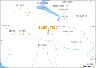
El Saltico (Villa Clara, Cuba)El Saltico is a town in the Villa Clara region of Cuba. An overview map of the region around El Saltico is displayed below.
regional and 3d topo map of El Saltico, Cuba ::
El Saltico airports ::
The nearest airport is CFG - Cienfuegos Jaime Gonzalez, located 42.7 km north west of El Saltico.
Other airports nearby include SNU - Santa Clara Abel Santamaria (59.2 km north), AVI - Ciego De Avila Maximo Gomez (130.3 km east), CYO - Cayo Vilo Acuna Intl (159.5 km west), VRA - Varadero Juan Gualberto Gomez Intl (185.2 km north west), Nearby towns ::
Charco Azul (0.0km north) //
Guanayara (1.7km east) //
Calabaza (1.7km east) //
Cien Rosas (2.5km north west) //
La Bandolera (2.5km south east) //
Cuatro Vientos (3.4km south west) //
Los Manantiales (3.9km north east) //
Aguacate (5.8km south) //
Topes de Collantes (6.6km south east) //
Cuatro Caminos (6.9km west) //
La Felicidad (7.2km east) //
Jibacoa (8.4km north east) //
Aserradero (8.4km north east) //
Veguitas (10.5km north east) //
El Nicho (10.4km north west) //
[all distances 'as the bird flies' and approximate] 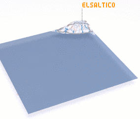 Places with similar names to El Saltico, Cuba ::
// EL Saltico (VE)
// El Saltigo (VE)
Disclaimer :: Information on this page comes without warranty of any kind |
||
|
Where is El Saltico? Elevation and coordinates ::
Latitude (lat): 21°58'0"N Longitude (lon): 80°3'0"W
Elevation (approx.): 414m (map arrows pan, magnifying glasses zoom) |
||
|
Visiting El Saltico? Hotel/Accommodation ::
Book a hotel in El Saltico Travel Guide ::
Buy a travel guide for Cuba rental cars ::
car rental offers GPS waypoint ::
download a GPX waypoint (PoI) of El Saltico for your GPS receiver
|
||