|
search place name
|
||
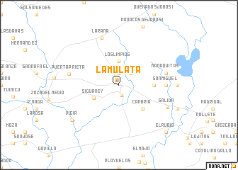
La Mulata (Sancti Spíritus, Cuba)La Mulata is a town in the Sancti Spíritus region of Cuba. An overview map of the region around La Mulata is displayed below.
regional and 3d topo map of La Mulata, Cuba ::
La Mulata airports ::
The nearest airport is AVI - Ciego De Avila Maximo Gomez, located 49.3 km east of La Mulata.
Other airports nearby include SNU - Santa Clara Abel Santamaria (87.4 km north west), CFG - Cienfuegos Jaime Gonzalez (119.3 km west), CMW - Camaguey Ignacio Agramonte Intl (161.0 km south east), Nearby towns ::
Edén (0.9km north west) //
Taguasco (1.7km south) //
Ciro Redondo (1.9km north) //
El Saltadero (2.5km north east) //
Los Limpios (3.7km north) //
Siguaney (4.2km south west) //
Cambria (5.1km south east) //
Rosita (5.2km east) //
San Miguel (6.9km east) //
La Serafina (6.9km east) //
Manaquitas (7.1km east) //
La Rana (7.8km north) //
Puerta Prieta (7.5km west) //
Salida (7.9km south east) //
Vigía (8.8km south west) //
El Rubio (10.1km south east) //
[all distances 'as the bird flies' and approximate] 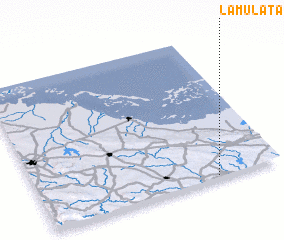 Places with similar names to La Mulata, Cuba ::
Disclaimer :: Information on this page comes without warranty of any kind |
||
|
Where is La Mulata? Elevation and coordinates ::
Latitude (lat): 22°1'0"N Longitude (lon): 79°16'0"W
Elevation (approx.): 103m (map arrows pan, magnifying glasses zoom) |
||
|
Visiting La Mulata? Hotel/Accommodation ::
Book a hotel in La Mulata Travel Guide ::
Buy a travel guide for Cuba rental cars ::
car rental offers GPS waypoint ::
download a GPX waypoint (PoI) of La Mulata for your GPS receiver
|
||