|
search place name
|
||
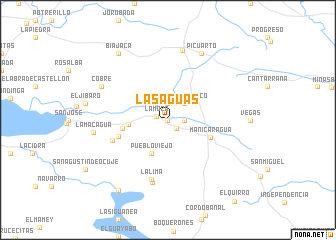
Las Aguas (Villa Clara, Cuba)Las Aguas is a town in the Villa Clara region of Cuba. An overview map of the region around Las Aguas is displayed below.
regional and 3d topo map of Las Aguas, Cuba ::
Las Aguas airports ::
The nearest airport is SNU - Santa Clara Abel Santamaria, located 36.8 km north of Las Aguas.
Other airports nearby include CFG - Cienfuegos Jaime Gonzalez (41.0 km west), AVI - Ciego De Avila Maximo Gomez (127.6 km east), CYO - Cayo Vilo Acuna Intl (169.4 km west), VRA - Varadero Juan Gualberto Gomez Intl (174.7 km north west), Nearby towns ::
Porvenir (0.0km north) //
La Moza (1.2km west) //
Peralejo (1.3km south east) //
Espejo (1.9km north) //
Victoria (1.7km east) //
San Francisco (2.5km north east) //
Ruico (2.5km north east) //
Pueblo Viejo (4.1km south west) //
Hoyo de Manicaragua (4.1km west) //
Manicaragua (4.8km south east) //
Ciro Redondo (4.8km west) //
Serrana (5.5km west) //
La Rosita (6.2km west) //
La Lima (6.9km south) //
Guanábana (7.1km south) //
Mataguá (7.9km north) //
Cobre (7.8km north west) //
Picuarto (8.2km north east) //
La Macagua (7.8km west) //
Biajaca (9.0km north west) //
El Salto del Hanabanilla (9.4km south west) //
[all distances 'as the bird flies' and approximate] 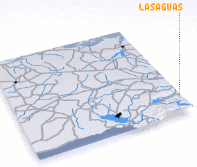 Places with similar names to Las Aguas, Cuba ::
// Las Guías (PA)
// Las Guías (PA)
// La Saxe (IT)
// Las Ciegas (CU)
// Los Ciegos (CU)
// Los Ciegos (CU)
// Lazukići (BA)
// Lazukići (BA)
// Las Aguas (ES)
// Los Cos (ES)
Disclaimer :: Information on this page comes without warranty of any kind |
||
|
Where is Las Aguas? Elevation and coordinates ::
Latitude (lat): 22°10'0"N Longitude (lon): 80°1'0"W
Elevation (approx.): 114m (map arrows pan, magnifying glasses zoom) |
||
|
Visiting Las Aguas? Hotel/Accommodation ::
Book a hotel in Las Aguas Travel Guide ::
Buy a travel guide for Cuba rental cars ::
car rental offers GPS waypoint ::
download a GPX waypoint (PoI) of Las Aguas for your GPS receiver
|
||