|
search place name
|
||
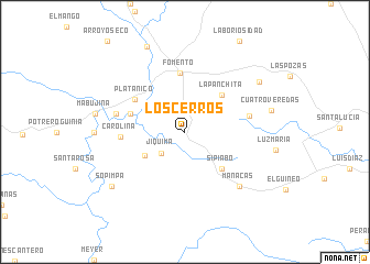
Los Cerros (Matanzas, Cuba)Los Cerros is a town in the Matanzas region of Cuba. An overview map of the region around Los Cerros is displayed below.
regional and 3d topo map of Los Cerros, Cuba ::
Los Cerros airports ::
The nearest airport is SNU - Santa Clara Abel Santamaria, located 54.3 km north west of Los Cerros.
Other airports nearby include CFG - Cienfuegos Jaime Gonzalez (72.8 km west), AVI - Ciego De Avila Maximo Gomez (95.7 km east), CYO - Cayo Vilo Acuna Intl (195.1 km west), CMW - Camaguey Ignacio Agramonte Intl (205.6 km east), Nearby towns ::
Jíquima (3.1km south west) //
Alonso (4.5km south west) //
La Panchita (5.1km north east) //
Sipiabo (5.1km south east) //
Altagracia (5.5km west) //
Fomento (6.0km north) //
Platanico (5.7km north west) //
Carolina (6.0km west) //
Cariblanca (6.2km east) //
Jaramillo (6.7km west) //
Manacas (7.6km south east) //
Cuatro Veredas (8.4km east) //
La Campana (8.6km north east) //
Sopimpa (8.8km south west) //
Agabama (9.4km north) //
[all distances 'as the bird flies' and approximate]  Places with similar names to Los Cerros, Cuba ::
// Lausers (DE)
// Los Cerros (PA)
// Los Cerros (PA)
// Los Cerros (PA)
// Los Ríos (PA)
// Los Ríos (PA)
// Los Ríos (PA)
// Laceiras (PT)
// Laceiras (PT)
// Laceiras (PT)
Disclaimer :: Information on this page comes without warranty of any kind |
||
|
Where is Los Cerros? Elevation and coordinates ::
Latitude (lat): 22°3'0"N Longitude (lon): 79°43'0"W
Elevation (approx.): 139m (map arrows pan, magnifying glasses zoom) |
||
|
Visiting Los Cerros? Hotel/Accommodation ::
Book a hotel in Los Cerros Travel Guide ::
Buy a travel guide for Cuba rental cars ::
car rental offers GPS waypoint ::
download a GPX waypoint (PoI) of Los Cerros for your GPS receiver
|
||