|
search place name
|
||
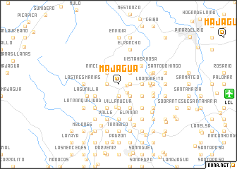
Majagua (Pinar del Río, Cuba)Majagua is a town in the Pinar del Río region of Cuba. An overview map of the region around Majagua is displayed below.
regional and 3d topo map of Majagua, Cuba ::
Majagua airports ::
The nearest airport is LCL - La Coloma, located 16.4 km east of Majagua.
Other airports nearby include GER - Nueva Gerona Rafael Cabrera (119.4 km south east), HAV - Havana Jose Marti Intl (159.5 km north east), Nearby towns ::
El Pitirre (1.2km east) //
La Caoba (1.7km west) //
Algarrobo (1.7km west) //
Saludes (1.7km east) //
Saludes (1.9km south) //
La Oprimada (1.9km south) //
Santa María (1.7km east) //
La María (1.9km south) //
La Malagueta (1.9km south) //
San Nicolás (1.9km south east) //
Rincón de la Ceiba (2.5km north west) //
Campo Alegre (2.5km north east) //
Calixto López (2.5km south east) //
Hondones (3.6km south) //
Campo Alegre de las Cañas (3.4km east) //
El Porvenir (3.4km east) //
La Tranca (3.4km east) //
Villa Nueva (3.7km south) //
Pueblo la Gloria (3.7km south) //
Río Seco (3.7km south) //
La Yaya (3.9km south east) //
Callejón de Tranca (3.9km south east) //
La Mulata (3.9km south east) //
La Arboleda (3.9km south east) //
Villamil (4.1km south west) //
Guanacay (4.1km south east) //
Cheo López (4.1km south east) //
El Potrerito (3.9km south west) //
Vista Hermosa (4.5km north east) //
[all distances 'as the bird flies' and approximate]  Places with similar names to Majagua, Cuba ::
Disclaimer :: Information on this page comes without warranty of any kind |
||
|
Where is Majagua? Elevation and coordinates ::
Latitude (lat): 22°21'0"N Longitude (lon): 83°48'0"W
Elevation (approx.): 59m (map arrows pan, magnifying glasses zoom) |
||
|
Visiting Majagua? Hotel/Accommodation ::
Book a hotel in Majagua Travel Guide ::
Buy a travel guide for Cuba rental cars ::
car rental offers GPS waypoint ::
download a GPX waypoint (PoI) of Majagua for your GPS receiver
|
||