|
search place name
|
||
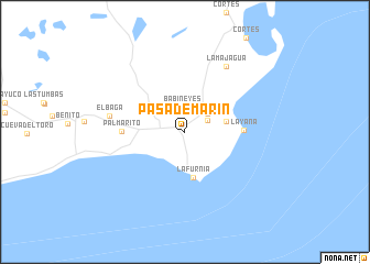
Pasa de Marín (Pinar del Río, Cuba)Pasa de Marín is a town in the Pinar del Río region of Cuba. An overview map of the region around Pasa de Marín is displayed below.
regional and 3d topo map of Pasa de Marín, Cuba ::
Pasa de Marín airports ::
The nearest airport is LCL - La Coloma, located 59.7 km north east of Pasa de Marín.
Other airports nearby include GER - Nueva Gerona Rafael Cabrera (131.9 km east), HAV - Havana Jose Marti Intl (204.2 km north east), Nearby towns ::
 Places with similar names to Pasa de Marín, Cuba ::
// Puesto Moreno (PY)
// Puesto Moreno (PY)
Disclaimer :: Information on this page comes without warranty of any kind |
||
|
Where is Pasa de Marín? Elevation and coordinates ::
Latitude (lat): 21°57'26"N Longitude (lon): 84°3'14"W
Elevation (approx.): 8m (map arrows pan, magnifying glasses zoom) |
||
|
Visiting Pasa de Marín? Hotel/Accommodation ::
Book a hotel in Pasa de Marín Travel Guide ::
Buy a travel guide for Cuba rental cars ::
car rental offers GPS waypoint ::
download a GPX waypoint (PoI) of Pasa de Marín for your GPS receiver
|
||