|
search place name
|
||
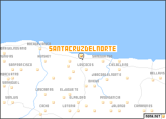
Santa Cruz del Norte (La Habana, Cuba)Santa Cruz del Norte is a town in the La Habana region of Cuba. An overview map of the region around Santa Cruz del Norte is displayed below.
regional and 3d topo map of Santa Cruz del Norte, Cuba ::
Santa Cruz del Norte airports ::
The nearest airport is VRA - Varadero Juan Gualberto Gomez Intl, located 51.7 km east of Santa Cruz del Norte.
Other airports nearby include HAV - Havana Jose Marti Intl (53.0 km west), EYW - Key West Intl (156.2 km north), NQX - Key West Nas (159.3 km north), GER - Nueva Gerona Rafael Cabrera (170.8 km south west), Nearby towns ::
Los Cocos (2.4km south) //
Pueblo Nuevo (2.7km west) //
Camilo Cienfuegos (3.4km south west) //
La Sierra (3.4km south west) //
San Eduardo (4.1km east) //
El Comino (4.9km south west) //
Cuatro Caminos (6.0km south) //
Oviedo (6.5km south) //
Jibacoa del Norte (6.7km south east) //
San Gabriel de Correderas (7.4km south west) //
Playa Jibacoa (7.5km east) //
El Juguete (8.3km south) //
Cielo Claro (7.9km east) //
Hershey (7.8km west) //
San Antonio de Río Blanco (9.4km south west) //
Las Cabras (11.1km south west) //
[all distances 'as the bird flies' and approximate] 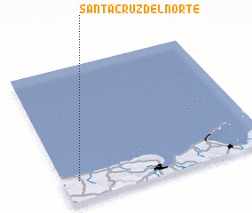 Places with similar names to Santa Cruz del Norte, Cuba :: Disclaimer :: Information on this page comes without warranty of any kind |
||
|
Where is Santa Cruz del Norte? Elevation and coordinates ::
Latitude (lat): 23°9'14"N Longitude (lon): 81°55'25"W
Elevation (approx.): 13m (map arrows pan, magnifying glasses zoom) |
||
|
Visiting Santa Cruz del Norte? Hotel/Accommodation ::
Book a hotel in Santa Cruz del Norte Travel Guide ::
Buy a travel guide for Cuba rental cars ::
car rental offers GPS waypoint ::
download a GPX waypoint (PoI) of Santa Cruz del Norte for your GPS receiver
|
||