|
search place name
|
||
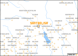
Santa Elisa (Pinar del Río, Cuba)Santa Elisa is a town in the Pinar del Río region of Cuba. An overview map of the region around Santa Elisa is displayed below.
regional and 3d topo map of Santa Elisa, Cuba ::
Santa Elisa airports ::
The nearest airport is LCL - La Coloma, located 43.4 km south west of Santa Elisa.
Other airports nearby include HAV - Havana Jose Marti Intl (105.9 km east), GER - Nueva Gerona Rafael Cabrera (106.9 km south east), VRA - Varadero Juan Gualberto Gomez Intl (203.2 km east), CYO - Cayo Vilo Acuna Intl (219.0 km south east), Nearby towns ::
San Diego de los Baños (1.5km north) //
Trinidad (1.9km south) //
La Mulata (1.7km west) //
El Desvío (1.7km west) //
La Niña (1.7km west) //
Calambuco (1.9km north) //
El Hato (1.9km north) //
Las Yeguas (1.9km north) //
Lote Prado (1.7km east) //
La Isleta (1.7km east) //
La Primera Vigía (1.7km east) //
Vista Hermosa (2.5km north east) //
Loma Candela (3.4km east) //
El Frijolillo (3.4km east) //
Candelaria (4.1km south west) //
Potosí (3.9km south west) //
María Luisa (4.1km south east) //
La Güira (4.3km west) //
Guachinanga (5.0km south east) //
El Peñón (5.0km south east) //
Las Marías (5.0km south east) //
Naranjal (5.1km west) //
Santa Ana (5.5km east) //
Porvenir (5.5km east) //
Lomas de Candelaria (5.8km south) //
El Indio (5.8km north) //
El Desengaño (5.5km east) //
Los Bermejales (6.3km north west) //
América (6.9km south west) //
[all distances 'as the bird flies' and approximate]  Places with similar names to Santa Elisa, Cuba ::
// Santa Alice (BR)
// Santa Elisa (BR)
// Santa Elisa (BR)
// Santa Eloísa (BR)
// Santa Luísa (BR)
// Santa Luísa (BR)
// Santa Luiza (BR)
// Santa Luz (BR)
// Santa Luzia (BR)
// Santa Luzia (BR)
Disclaimer :: Information on this page comes without warranty of any kind |
||
|
Where is Santa Elisa? Elevation and coordinates ::
Latitude (lat): 22°38'0"N Longitude (lon): 83°22'0"W
Elevation (approx.): 71m (map arrows pan, magnifying glasses zoom) |
||
|
Visiting Santa Elisa? Hotel/Accommodation ::
Book a hotel in Santa Elisa Travel Guide ::
Buy a travel guide for Cuba rental cars ::
car rental offers GPS waypoint ::
download a GPX waypoint (PoI) of Santa Elisa for your GPS receiver
|
||