|
search place name
|
||
Santa Fé (Ciudad de La Habana, Cuba)Santa Fé is a town in the Ciudad de La Habana region of Cuba. An overview map of the region around Santa Fé is displayed below.
regional and 3d topo map of Santa Fé, Cuba ::

Santa Fé airports ::
The nearest airport is HAV - Havana Jose Marti Intl, located 14.1 km south east of Santa Fé.
Other airports nearby include VRA - Varadero Juan Gualberto Gomez Intl (110.6 km east), GER - Nueva Gerona Rafael Cabrera (139.8 km south), LCL - La Coloma (141.7 km south west), EYW - Key West Intl (181.4 km north east), Nearby towns ::
Emilia González (0.7km south west) //
Reparto Nuevo (1.9km north east) //
San Miguel (2.5km south) //
La Conchita (2.5km south) //
Cangrejeras (2.8km south) //
Corrales (3.2km south west) //
Barlovento (3.3km north east) //
Alameda del Siboney (3.5km east) //
Jaimanitas (3.7km north east) //
Cuatro Caminos de Falcón (3.9km south east) //
Santa Edita (4.5km south west) //
El Cafetal (4.8km south west) //
Nueva Coronela (4.8km east) //
Alturas de la Coronela (4.8km east) //
Siboney (4.8km east) //
Alturas de Cubanacán (4.9km east) //
Cantarranas (5.4km south east) //
San Agustín (5.3km east) //
Arroyo Arenas (5.5km south east) //
Punta Brava (6.1km south) //
Playa Baracoa (6.2km west) //
El Atrevido (6.4km south east) //
Cubanacán (6.6km east) //
Versalles (6.7km east) //
El Cano (7.0km south east) //
Reparto Náutico (6.9km north east) //
Arimao (6.9km east) //
San Rafael (6.9km east) //
Balcón de la Lisa (6.9km east) //
[all distances 'as the bird flies' and approximate] 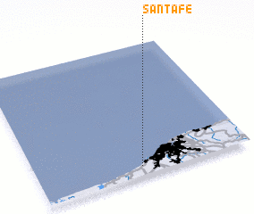 Places with similar names to Santa Fé, Cuba ::
Disclaimer :: Information on this page comes without warranty of any kind |
||
|
Where is Santa Fé? Elevation and coordinates ::
Latitude (lat): 23°4'19"N Longitude (lon): 82°30'48"W
Elevation (approx.): 3m (map arrows pan, magnifying glasses zoom) |
||
|
Visiting Santa Fé? Hotel/Accommodation ::
Book a hotel in Santa Fé Travel Guide ::
Buy a travel guide for Cuba rental cars ::
car rental offers GPS waypoint ::
download a GPX waypoint (PoI) of Santa Fé for your GPS receiver
|
||