|
search place name
|
||
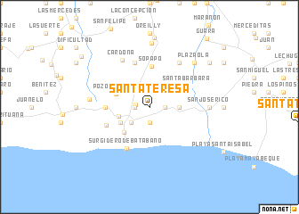
Santa Teresa (La Habana, Cuba)Santa Teresa is a town in the La Habana region of Cuba. An overview map of the region around Santa Teresa is displayed below.
regional and 3d topo map of Santa Teresa, Cuba ::
Santa Teresa airports ::
The nearest airport is HAV - Havana Jose Marti Intl, located 31.9 km north west of Santa Teresa.
Other airports nearby include VRA - Varadero Juan Gualberto Gomez Intl (91.6 km east), GER - Nueva Gerona Rafael Cabrera (112.9 km south west), CYO - Cayo Vilo Acuna Intl (144.3 km south east), LCL - La Coloma (148.2 km west), Nearby towns ::
Juan Díaz (1.7km west) //
Rojas (1.7km west) //
San Pedro (1.7km west) //
San Ramón (1.9km south) //
Ramírez (1.9km north) //
Santa Rita (1.9km north) //
Bodega Caimán (1.7km east) //
La Serafina (2.6km north) //
Cafetal (2.5km north west) //
Rabo de Zorro (2.5km north west) //
San Antonio (2.5km north east) //
Batabanó (2.9km south west) //
Bodega Azcaratico (3.4km east) //
Quintana (3.8km west) //
San Miguel (3.9km south west) //
Acueducto (3.9km south west) //
Santa Filomena (3.9km north east) //
Pozo Redondo (4.2km north west) //
San Vicente (4.3km south west) //
Sopapo (5.1km north) //
Santa Bárbara (5.0km north east) //
Berriel (5.1km west) //
Santo Tomás (5.5km south west) //
Rissel (5.8km north) //
Surgidero de Batabanó (5.8km south west) //
San Francisco (6.5km north east) //
Cardona (6.7km north west) //
San José Rico (6.8km east) //
Santa Lucía (7.0km west) //
[all distances 'as the bird flies' and approximate] 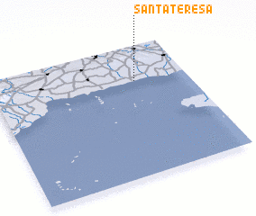 Places with similar names to Santa Teresa, Cuba ::
// Santa Teresa (BR)
// Santa Teresa (BR)
// Santa Teresa (BR)
// Santa Teresa (BR)
// Santa Teresa (BR)
// Santa Teresa (BR)
// Santa Teresa (BR)
// Santa Teresa (BR)
// Santa Teresa (BR)
// Santa Teresa (BR)
Disclaimer :: Information on this page comes without warranty of any kind |
||
|
Where is Santa Teresa? Elevation and coordinates ::
Latitude (lat): 22°44'0"N Longitude (lon): 82°16'0"W
Elevation (approx.): 13m (map arrows pan, magnifying glasses zoom) |
||
|
Visiting Santa Teresa? Hotel/Accommodation ::
Book a hotel in Santa Teresa Travel Guide ::
Buy a travel guide for Cuba rental cars ::
car rental offers GPS waypoint ::
download a GPX waypoint (PoI) of Santa Teresa for your GPS receiver
|
||