|
search place name
|
||
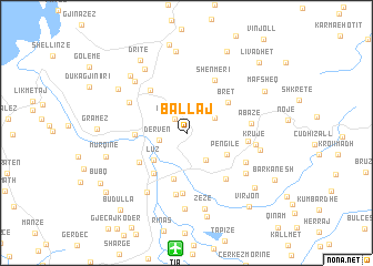
Ballaj (Durrës, Albania)Ballaj is a town in the Durrës region of Albania. An overview map of the region around Ballaj is displayed below.
regional and 3d topo map of Ballaj, Albania ::
Ballaj airports ::
The nearest airport is TIA - Tirana Rinas, located 11.7 km south of Ballaj.
Other airports nearby include OHD - Ohrid (92.8 km south east), TGD - Podgorica (101.3 km north west), TIV - Tivat (128.9 km north west), PRN - Pristina (159.3 km north east), Nearby towns ::
Burizanë (1.6km north west) //
Derven (2.2km west) //
Picrragë (2.6km north east) //
Zallaj (3.1km south east) //
Luz (3.7km south west) //
(( Pengile )) (3.8km south east) //
Fushë-Krujë (4.7km south) //
Bush (3.9km west) //
Bret (4.4km north east) //
Hasan (4.8km south west) //
Shpërdhet (5.1km north west) //
Bilaj (4.7km south west) //
Shënmëri (5.7km north) //
Zgërdhesh (5.5km south east) //
Arameras (6.1km south) //
Bellaj (4.7km east) //
Shëmri (6.2km south) //
Thumanë (5.3km north west) //
Abazë (4.9km east) //
Mzillë (5.4km south east) //
Krujë (5.4km east) //
Breg Shkozë (6.7km south west) //
(( Hasmuçaj )) (6.0km south east) //
Kodër Thumanë (6.5km north west) //
Mamurras (7.1km north west) //
Larushk (7.7km south) //
Berbere (5.9km east) //
Zezë (7.7km south) //
Fushë-Mamurras (7.1km north west) //
[all distances 'as the bird flies' and approximate] 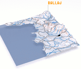 Places with similar names to Ballaj, Albania ::
Disclaimer :: Information on this page comes without warranty of any kind |
||
|
Where is Ballaj? Elevation and coordinates ::
Latitude (lat): 41°31'11"N Longitude (lon): 19°43'47"E
Elevation (approx.): 28m (map arrows pan, magnifying glasses zoom) |
||
|
Visiting Ballaj? Hotel/Accommodation ::
Book a hotel in Ballaj Travel Guide ::
Buy a travel guide for Albania rental cars ::
car rental offers GPS waypoint ::
download a GPX waypoint (PoI) of Ballaj for your GPS receiver
|
||