|
search place name
|
||
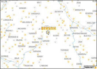
Brasnik (Elbasan, Albania)Brasnik is a town in the Elbasan region of Albania. An overview map of the region around Brasnik is displayed below.
regional and 3d topo map of Brasnik, Albania ::
Brasnik airports ::
The nearest airport is OHD - Ohrid, located 67.8 km north east of Brasnik.
Other airports nearby include TIA - Tirana Rinas (78.1 km north west), KSO - Kastoria Aristotelis (104.4 km east), CFU - Kerkyra/corfu Ioannis Kapodistrias Intl (132.5 km south), IOA - Ioannina (134.3 km south east), Nearby towns ::
Sergjovë (0.9km south west) //
Vrri (2.1km north) //
Jançë (2.2km north west) //
Jançë-Mal (2.1km west) //
Ulovë (2.7km south east) //
Dardhë (3.7km south) //
Dumberas (2.9km east) //
Qafë-Dardhë (3.5km south east) //
Fert (3.5km south west) //
Vresht (4.3km south west) //
Hoxhallar (4.7km north west) //
Tabak (3.9km west) //
Tunja e Re (5.1km north) //
(( Shënmitër )) (4.8km north east) //
Gjeraqinë (4.6km north east) //
Kostreni i Madh (4.5km south west) //
(( Delven )) (4.6km north east) //
Turanët (4.5km west) //
Tunjë (5.9km north) //
Perisnakë (5.7km south west) //
Çiflik (5.8km north east) //
Dukovë (5.5km south west) //
Mëndrakë (5.1km north west) //
Kushovë (5.0km east) //
Duzhë (6.6km north) //
Marish (5.5km south east) //
Leshtar (6.3km north west) //
Prroi (6.2km north east) //
Kamerllas (6.0km north west) //
[all distances 'as the bird flies' and approximate] 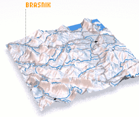 Places with similar names to Brasnik, Albania ::
Disclaimer :: Information on this page comes without warranty of any kind |
||
|
Where is Brasnik? Elevation and coordinates ::
Latitude (lat): 40°46'59"N Longitude (lon): 20°7'49"E
Elevation (approx.): 571m (map arrows pan, magnifying glasses zoom) |
||
|
Visiting Brasnik? Hotel/Accommodation ::
Book a hotel in Brasnik Travel Guide ::
Buy a travel guide for Albania rental cars ::
car rental offers GPS waypoint ::
download a GPX waypoint (PoI) of Brasnik for your GPS receiver
|
||