|
search place name
|
||
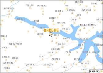
Dardhë (Shkodër, Albania)Dardhë is a town in the Shkodër region of Albania. An overview map of the region around Dardhë is displayed below.
regional and 3d topo map of Dardhë, Albania ::
Dardhë airports ::
The nearest airport is TGD - Podgorica, located 76.9 km west of Dardhë.
Other airports nearby include PRN - Pristina (83.6 km north east), TIA - Tirana Rinas (94.0 km south west), TIV - Tivat (120.6 km west), OHD - Ohrid (122.8 km south east), Nearby towns ::
Pirac (1.6km south) //
Qibik (1.4km south east) //
Truen (2.5km south east) //
Shëngjergj (2.9km north) //
Mëzi (3.3km north west) //
Gurrë (3.0km west) //
Rushtë (4.6km north) //
Blerim (4.8km south east) //
Berishë (4.9km north east) //
Kulumri (5.7km south) //
Mashë (5.8km north) //
Visoçë (4.5km north east) //
Rajzë (4.5km east) //
Arst (4.7km north west) //
Xath (6.7km south) //
Çukë (6.0km north west) //
Gjonpapaj (7.2km north) //
Apripa e Keke (6.2km north west) //
Miliska (6.6km west) //
Majac (8.5km north) //
Rexhaj (8.6km north) //
Flet (8.6km south) //
Pistë (8.1km south east) //
Leniq (7.9km north east) //
Çorraj (10.2km north east) //
Lagjja e Sipërme (9.9km north east) //
[all distances 'as the bird flies' and approximate]  Places with similar names to Dardhë, Albania ::
// Triádha (GR)
// Triádha (GR)
// Dardhë (AL)
// Dardhë (AL)
// Dardhë (AL)
// Dardhë (AL)
// Darreh Dohū (IR)
// Tārādehi (IN)
// Turdho (SO)
// Douar Retaïhia (DZ)
Disclaimer :: Information on this page comes without warranty of any kind |
||
|
Where is Dardhë? Elevation and coordinates ::
Latitude (lat): 42°11'42"N Longitude (lon): 20°9'28"E
Elevation (approx.): 535m (map arrows pan, magnifying glasses zoom) |
||
|
Visiting Dardhë? Hotel/Accommodation ::
Book a hotel in Dardhë Travel Guide ::
Buy a travel guide for Albania rental cars ::
car rental offers GPS waypoint ::
download a GPX waypoint (PoI) of Dardhë for your GPS receiver
|
||