|
search place name
|
||
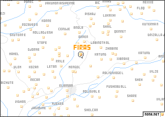
Firas (Elbasan, Albania)Firas is a town in the Elbasan region of Albania. An overview map of the region around Firas is displayed below.
regional and 3d topo map of Firas, Albania ::
Firas airports ::
The nearest airport is TIA - Tirana Rinas, located 42.2 km north west of Firas.
Other airports nearby include OHD - Ohrid (52.7 km east), KSO - Kastoria Aristotelis (127.7 km south east), TGD - Podgorica (149.5 km north west), SKP - Skopje (152.9 km north east), Nearby towns ::
Griqan (2.2km south east) //
(( Mengël )) (3.3km south) //
Preça e Poshtme (2.7km west) //
Guri i Zi (3.5km north) //
Godolesh (3.4km south west) //
Orpen (3.8km north) //
Katund (3.2km east) //
Labinot-Mal (4.1km north east) //
Rrilë (4.1km south west) //
(( Krrabë e Vogël )) (4.0km west) //
Branesh (4.1km west) //
Labinot-Fushë (4.9km south east) //
Preça e Sipërme (4.7km north west) //
Anola (6.0km north) //
Prapanikë (4.8km east) //
Funar (5.0km north west) //
Bixëlle (5.2km west) //
Cërujë (6.4km north west) //
Zhabinë (5.3km east) //
Letan (5.9km south west) //
Sinanaj (6.9km north east) //
Sericë (5.7km east) //
Fezruç (7.5km north) //
Gurabardh (6.4km south west) //
Qafë (7.0km north east) //
Elbasan (7.7km south) //
Polisi i Vogël (6.9km south east) //
Benë (8.3km north) //
(( Shmil )) (7.6km north east) //
[all distances 'as the bird flies' and approximate]  Places with similar names to Firas, Albania ::
Disclaimer :: Information on this page comes without warranty of any kind |
||
|
Where is Firas? Elevation and coordinates ::
Latitude (lat): 41°10'40"N Longitude (lon): 20°6'51"E
Elevation (approx.): 735m (map arrows pan, magnifying glasses zoom) |
||
|
Visiting Firas? Hotel/Accommodation ::
Book a hotel in Firas Travel Guide ::
Buy a travel guide for Albania rental cars ::
car rental offers GPS waypoint ::
download a GPX waypoint (PoI) of Firas for your GPS receiver
|
||