|
search place name
|
||
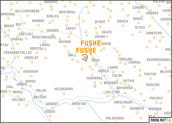
Fushë (Gjirokastër, Albania)Fushë is a town in the Gjirokastër region of Albania. An overview map of the region around Fushë is displayed below.
regional and 3d topo map of Fushë, Albania ::
Fushë airports ::
The nearest airport is CFU - Kerkyra/corfu Ioannis Kapodistrias Intl, located 88.6 km south of Fushë.
Other airports nearby include IOA - Ioannina (95.9 km south east), KSO - Kastoria Aristotelis (97.5 km east), OHD - Ohrid (102.5 km north east), TIA - Tirana Rinas (120.1 km north), Nearby towns ::
Mullahaj (1.1km north west) //
Potgoran-Fushë (1.3km south east) //
Lotonjaj (1.4km north east) //
Çorogunj (1.4km west) //
Potgoran (1.7km south west) //
Fushë (1.8km north east) //
Fshati i Ri (2.0km north) //
Sukë (1.7km east) //
Qaf Sukë (2.0km south east) //
Ball (2.3km west) //
Saliaj (2.9km north) //
Bokollar (3.1km south) //
Gjergas (3.4km north) //
Ballaban (4.0km north) //
Rodenj (3.5km north east) //
Psar (3.6km north west) //
Taroninë (4.1km north east) //
Goricë (4.2km south east) //
Xhuhanoj (4.8km south) //
Pavar (5.0km north east) //
Mullahaj (5.4km south) //
Çorenisht (5.2km south east) //
Vinokash (5.7km north) //
Katundishtë (5.6km south) //
Mazhan (5.0km north west) //
Luarë (4.9km south east) //
Veleshnjaret (6.6km north) //
Komarak (6.1km north west) //
Vinokash-Fushë (6.6km north) //
[all distances 'as the bird flies' and approximate] 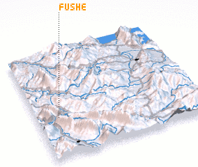 Places with similar names to Fushë, Albania ::
Disclaimer :: Information on this page comes without warranty of any kind |
||
|
Where is Fushë? Elevation and coordinates ::
Latitude (lat): 40°22'50"N Longitude (lon): 20°8'11"E
Elevation (approx.): 287m (map arrows pan, magnifying glasses zoom) |
||
|
Visiting Fushë? Hotel/Accommodation ::
Book a hotel in Fushë Travel Guide ::
Buy a travel guide for Albania rental cars ::
car rental offers GPS waypoint ::
download a GPX waypoint (PoI) of Fushë for your GPS receiver
|
||