|
search place name
|
||
Gjegjan (Kukës, Albania)Gjegjan is a town in the Kukës region of Albania. An overview map of the region around Gjegjan is displayed below.
regional and 3d topo map of Gjegjan, Albania ::

Gjegjan airports ::
The nearest airport is PRN - Pristina, located 70.1 km north east of Gjegjan.
Other airports nearby include SKP - Skopje (95.3 km east), TIA - Tirana Rinas (98.5 km south west), OHD - Ohrid (103.6 km south), TGD - Podgorica (106.0 km west), Nearby towns ::
Matmilj (1.7km south) //
Norgut (1.5km north east) //
Bardhoc (2.3km north east) //
(( Xhah )) (2.5km north east) //
Përbreg (3.1km west) //
Lumë (3.7km south west) //
(( San Sula )) (3.9km north west) //
Bardhoci i Ri (4.0km north east) //
Ferth (4.4km south west) //
Fezuk (4.3km north west) //
Domaj (5.1km north) //
Gjinaj (4.9km north west) //
Bele (5.3km south east) //
Kukës (5.4km west) //
Lojme (7.0km south) //
Ramhas-Kukës (5.7km west) //
Morin (6.7km north east) //
Shtiqën (7.1km south west) //
Orçikël (7.1km south east) //
Gostil (6.9km south west) //
Rexhaj (7.7km north east) //
Zapod (7.3km south east) //
Nimçë (9.0km south) //
(( Shalqin )) (8.7km north east) //
Pusi i Thatë (7.4km north west) //
Nimçë (8.8km south east) //
Pogaj (9.5km north east) //
Krenxë (9.2km south west) //
Cërnalevë (9.1km south east) //
[all distances 'as the bird flies' and approximate] 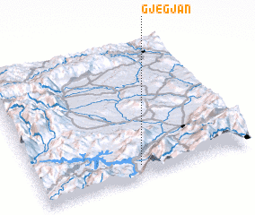 Places with similar names to Gjegjan, Albania ::
// Gjegjan (AL)
Disclaimer :: Information on this page comes without warranty of any kind |
||
|
Where is Gjegjan? Elevation and coordinates ::
Latitude (lat): 42°5'33"N Longitude (lon): 20°29'3"E
Elevation (approx.): 581m (map arrows pan, magnifying glasses zoom) |
||
|
Visiting Gjegjan? Hotel/Accommodation ::
Book a hotel in Gjegjan Travel Guide ::
Buy a travel guide for Albania rental cars ::
car rental offers GPS waypoint ::
download a GPX waypoint (PoI) of Gjegjan for your GPS receiver
|
||