|
search place name
|
||
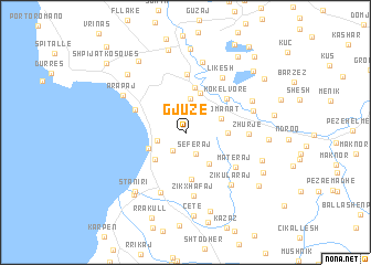
Gjuzë (Durrës, Albania)Gjuzë is a town in the Durrës region of Albania. An overview map of the region around Gjuzë is displayed below.
regional and 3d topo map of Gjuzë, Albania ::
Gjuzë airports ::
The nearest airport is TIA - Tirana Rinas, located 20.8 km north east of Gjuzë.
Other airports nearby include OHD - Ohrid (99.4 km east), TGD - Podgorica (123.8 km north), TIV - Tivat (144.1 km north west), BDS - Brindisi Casale (152.1 km south west), Nearby towns ::
(( Muharremaj )) (2.0km north) //
Tilaj (2.0km south west) //
Seferaj (2.3km south) //
Manskur (2.3km north west) //
Kryemëdhej (2.3km west) //
Mezaj (3.5km north) //
Rromanat (3.1km north east) //
Golemas (3.6km south east) //
Golemas (3.2km south west) //
Golem (3.5km south west) //
Bozanxhije (3.2km east) //
Hardhishtë (4.2km north) //
Pjezgë (4.6km north) //
Kanaparaj (4.7km south) //
(( Kokëlvorë )) (4.6km north east) //
Shkallnur (4.5km north west) //
Rreth (5.9km north) //
Materaj (5.1km south east) //
Zhurje (4.8km east) //
Zikxhafaj (6.4km south) //
Aganas (6.3km south) //
Likesh (6.2km north east) //
Zikularaj (6.3km south east) //
Çizmeli (5.6km north east) //
Gjepalaj (7.2km north) //
Arapaj (6.1km north west) //
Eminasi i Vogël (6.0km north east) //
(( Stan i Ri )) (7.0km south west) //
Kërçukje (6.4km south east) //
[all distances 'as the bird flies' and approximate] 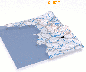 Places with similar names to Gjuzë, Albania ::
Disclaimer :: Information on this page comes without warranty of any kind |
||
|
Where is Gjuzë? Elevation and coordinates ::
Latitude (lat): 41°16'10"N Longitude (lon): 19°33'47"E
Elevation (approx.): 171m (map arrows pan, magnifying glasses zoom) |
||
|
Visiting Gjuzë? Hotel/Accommodation ::
Book a hotel in Gjuzë Travel Guide ::
Buy a travel guide for Albania rental cars ::
car rental offers GPS waypoint ::
download a GPX waypoint (PoI) of Gjuzë for your GPS receiver
|
||