|
search place name
|
||
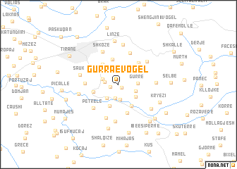
Gurra e Vogël (Tiranë, Albania)Gurra e Vogël is a town in the Tiranë region of Albania. An overview map of the region around Gurra e Vogël is displayed below.
regional and 3d topo map of Gurra e Vogël, Albania ::
Gurra e Vogël airports ::
The nearest airport is TIA - Tirana Rinas, located 20.0 km north west of Gurra e Vogël.
Other airports nearby include OHD - Ohrid (72.6 km east), TGD - Podgorica (130.4 km north west), KSO - Kastoria Aristotelis (150.0 km south east), TIV - Tivat (157.4 km north west), Nearby towns ::
Dais-Barbas (0.6km south east) //
Dallashi (1.1km west) //
Lundër (1.7km west) //
(( Fikas )) (2.2km south) //
(( Daias )) (2.2km south) //
Shejleret (2.3km north) //
Fikas-Mangull (2.4km south) //
Farka e Madhe (2.1km north west) //
Mullet (2.5km south west) //
(( Barbas )) (2.3km south east) //
Gurrë (2.3km east) //
Farka e Madhe (2.8km north west) //
Mangull (2.8km south east) //
Dobresh (3.6km south) //
Qehë-Shytaj (3.8km south east) //
Çollak (3.7km north west) //
Ballaj (4.0km north) //
Çeliku (3.2km west) //
(( Lalej )) (4.1km north east) //
Bërzhitë (4.7km south) //
Kokli (4.2km north east) //
Surrel (5.1km north) //
Mjull-Bathore (4.0km west) //
Petrelë (4.7km south west) //
Shënkoll (5.4km south) //
Shkozë (5.5km north) //
Priska e Madhe (5.0km north east) //
Durisht (5.9km south) //
Përcëllesh (4.5km east) //
[all distances 'as the bird flies' and approximate]  Places with similar names to Gurra e Vogël, Albania ::
// Gurra e Vogël (AL)
Disclaimer :: Information on this page comes without warranty of any kind |
||
|
Where is Gurra e Vogël? Elevation and coordinates ::
Latitude (lat): 41°17'11"N Longitude (lon): 19°53'18"E
Elevation (approx.): 214m (map arrows pan, magnifying glasses zoom) |
||
|
Visiting Gurra e Vogël? Hotel/Accommodation ::
Book a hotel in Gurra e Vogël Travel Guide ::
Buy a travel guide for Albania rental cars ::
car rental offers GPS waypoint ::
download a GPX waypoint (PoI) of Gurra e Vogël for your GPS receiver
|
||