|
search place name
|
||
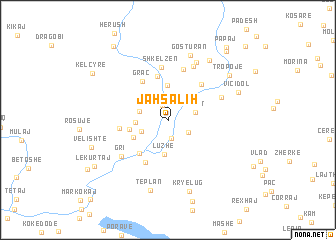
Jah Salih (Kukës, Albania)Jah Salih is a town in the Kukës region of Albania. An overview map of the region around Jah Salih is displayed below.
regional and 3d topo map of Jah Salih, Albania ::
Jah Salih airports ::
The nearest airport is TGD - Podgorica, located 70.3 km west of Jah Salih.
Other airports nearby include PRN - Pristina (80.1 km east), TIA - Tirana Rinas (109.6 km south), TIV - Tivat (114.0 km west), SKP - Skopje (132.8 km east), Nearby towns ::
Paqe (1.7km north) //
Llugaj (2.0km south) //
Rreze-Mali (2.2km south east) //
Shoshan (3.0km north) //
(( Sopot )) (2.4km east) //
Dojan (2.6km south west) //
Margegaj (2.6km west) //
Babinë (3.1km north east) //
Koçanaj (3.0km north west) //
Bajram Curri (2.7km west) //
Luzhë (3.8km south) //
Begaj (3.9km north) //
Bllatë (3.4km south west) //
(( Vushnicë )) (3.4km west) //
Bujan (4.3km south west) //
Dretovë (5.0km north) //
Graç (4.9km north west) //
(( Dunishë )) (5.0km south) //
(( Fang )) (5.0km south) //
Shumicë-Ahmataj (4.8km north east) //
Markaj (4.1km west) //
Kërrnajë (5.8km north) //
Shkëlzen (5.9km north) //
Mejdan (5.1km north east) //
Gri (5.5km south west) //
Kovaç (6.4km north) //
(( Hoxhaj )) (6.8km north) //
Gosturan (7.4km north) //
Tëplan (8.0km south) //
[all distances 'as the bird flies' and approximate]  Places with similar names to Jah Salih, Albania ::
Disclaimer :: Information on this page comes without warranty of any kind |
||
|
Where is Jah Salih? Elevation and coordinates ::
Latitude (lat): 42°21'32"N Longitude (lon): 20°6'21"E
Elevation (approx.): 309m (map arrows pan, magnifying glasses zoom) |
||
|
Visiting Jah Salih? Hotel/Accommodation ::
Book a hotel in Jah Salih Travel Guide ::
Buy a travel guide for Albania rental cars ::
car rental offers GPS waypoint ::
download a GPX waypoint (PoI) of Jah Salih for your GPS receiver
|
||