|
search place name
|
||
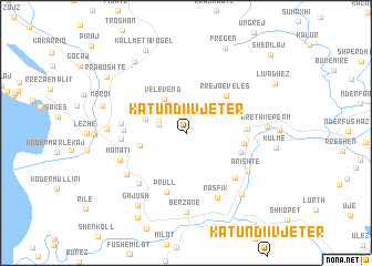
Katundi i Vjetër (Lezhë, Albania)Katundi i Vjetër is a town in the Lezhë region of Albania. An overview map of the region around Katundi i Vjetër is displayed below.
regional and 3d topo map of Katundi i Vjetër, Albania ::
Katundi i Vjetër airports ::
The nearest airport is TIA - Tirana Rinas, located 41.1 km south of Katundi i Vjetër.
Other airports nearby include TGD - Podgorica (75.3 km north west), OHD - Ohrid (107.7 km south east), TIV - Tivat (108.3 km north west), PRN - Pristina (138.7 km north east), Nearby towns ::
Lalm-Lukaj (2.2km north west) //
(( Lalmë )) (2.3km north west) //
Velë-Vend (3.8km north west) //
Kaçinar (3.4km north west) //
Fildanë (3.7km west) //
Gjash (4.4km north west) //
Rreja e Velës (4.8km north east) //
(( Bulshizë )) (4.6km south east) //
Rubik (4.5km east) //
Munaz (4.6km east) //
Prull (6.1km south) //
Rreja e Zezë (5.1km north east) //
Kolç (4.8km west) //
Grykë-Manati (4.9km west) //
Patalej (5.0km west) //
Fierzë (5.9km south east) //
Spiten (6.2km south west) //
Manati (5.7km south west) //
Rasfik (7.0km south) //
(( Arishtë )) (6.0km south east) //
Tresh (6.2km south west) //
Bërzanë (8.0km south) //
(( Varosh )) (6.0km west) //
Rrethi i Epërm (6.1km east) //
Fangu (7.5km south east) //
Gajush (8.2km south west) //
Kallmeti i Madh (8.1km north west) //
Merqi (6.9km north west) //
Kallmeti i Vogël (8.9km north) //
[all distances 'as the bird flies' and approximate] 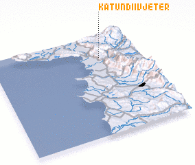 Places with similar names to Katundi i Vjetër, Albania ::
// Katundi i Vjetër (AL)
Disclaimer :: Information on this page comes without warranty of any kind |
||
|
Where is Katundi i Vjetër? Elevation and coordinates ::
Latitude (lat): 41°47'4"N Longitude (lon): 19°44'0"E
Elevation (approx.): 332m (map arrows pan, magnifying glasses zoom) |
||
|
Visiting Katundi i Vjetër? Hotel/Accommodation ::
Book a hotel in Katundi i Vjetër Travel Guide ::
Buy a travel guide for Albania rental cars ::
car rental offers GPS waypoint ::
download a GPX waypoint (PoI) of Katundi i Vjetër for your GPS receiver
|
||