|
search place name
|
||
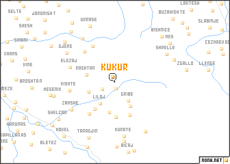
Kukur (Elbasan, Albania)Kukur is a town in the Elbasan region of Albania. An overview map of the region around Kukur is displayed below.
regional and 3d topo map of Kukur, Albania ::
Kukur airports ::
The nearest airport is OHD - Ohrid, located 47.1 km north east of Kukur.
Other airports nearby include TIA - Tirana Rinas (81.3 km north west), KSO - Kastoria Aristotelis (90.7 km south east), IOA - Ioannina (135.8 km south), KZI - Kozani Filippos (140.8 km south east), Nearby towns ::
Vreshtas (1.0km south) //
Lagjja i Vjetër (2.0km south west) //
Gribë (3.5km south east) //
Lilaj (3.9km south west) //
Grazhdan (3.6km south west) //
Kalaj (4.4km south east) //
Rashtan (3.7km west) //
Sojnik (5.1km south) //
Snosem (5.0km south west) //
Mukaj (5.7km south) //
Rmath (5.7km south) //
(( Mollë )) (6.1km south west) //
Çekrezë (6.5km north west) //
Holtas (6.2km north west) //
Kishtë (5.8km west) //
Elezaj (6.1km north west) //
Zamshë (7.1km south west) //
Lleshaj (8.1km north west) //
Gjerë (7.7km north west) //
Grabova e Sipërme (8.9km south east) //
Shpellë (7.8km north east) //
(( Çarçiaj )) (9.0km north west) //
Bishnicë (9.4km north east) //
Poroçan (9.9km north west) //
[all distances 'as the bird flies' and approximate] 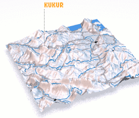 Places with similar names to Kukur, Albania ::
Disclaimer :: Information on this page comes without warranty of any kind |
||
|
Where is Kukur? Elevation and coordinates ::
Latitude (lat): 40°52'4"N Longitude (lon): 20°21'49"E
Elevation (approx.): 803m (map arrows pan, magnifying glasses zoom) |
||
|
Visiting Kukur? Hotel/Accommodation ::
Book a hotel in Kukur Travel Guide ::
Buy a travel guide for Albania rental cars ::
car rental offers GPS waypoint ::
download a GPX waypoint (PoI) of Kukur for your GPS receiver
|
||