|
search place name
|
||
Leshnjë (Korçë, Albania)Leshnjë is a town in the Korçë region of Albania. An overview map of the region around Leshnjë is displayed below.
regional and 3d topo map of Leshnjë, Albania ::

Leshnjë airports ::
The nearest airport is KSO - Kastoria Aristotelis, located 57.4 km east of Leshnjë.
Other airports nearby include OHD - Ohrid (73.3 km north), IOA - Ioannina (94.0 km south), KZI - Kozani Filippos (107.6 km east), CFU - Kerkyra/corfu Ioannis Kapodistrias Intl (118.9 km south west), Nearby towns ::
Vithkuq (2.6km west) //
Gjanç (3.0km north east) //
Rehovë (4.6km south) //
Roshanj (5.9km south) //
Lubonjë (6.6km south) //
Dërsnik (6.5km north east) //
Ujëbardhë (6.0km east) //
Gjergjevicë (8.0km north west) //
Lavdari i Korcës (8.9km north east) //
Selenica e Pishës (9.6km south west) //
Helmës (10.0km south east) //
Katund-Stratobërdë (10.1km south west) //
[all distances 'as the bird flies' and approximate] 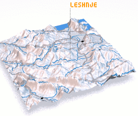 Places with similar names to Leshnjë, Albania ::
Disclaimer :: Information on this page comes without warranty of any kind |
||
|
Where is Leshnjë? Elevation and coordinates ::
Latitude (lat): 40°31'39"N Longitude (lon): 20°36'48"E
Elevation (approx.): 1092m (map arrows pan, magnifying glasses zoom) |
||
|
Visiting Leshnjë? Hotel/Accommodation ::
Book a hotel in Leshnjë Travel Guide ::
Buy a travel guide for Albania rental cars ::
car rental offers GPS waypoint ::
download a GPX waypoint (PoI) of Leshnjë for your GPS receiver
|
||