|
search place name
|
||
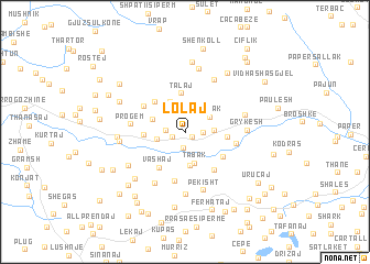
Lolaj (Elbasan, Albania)Lolaj is a town in the Elbasan region of Albania. An overview map of the region around Lolaj is displayed below.
regional and 3d topo map of Lolaj, Albania ::
Lolaj airports ::
The nearest airport is TIA - Tirana Rinas, located 40.8 km north of Lolaj.
Other airports nearby include OHD - Ohrid (79.5 km east), KSO - Kastoria Aristotelis (141.4 km south east), TGD - Podgorica (152.3 km north), CFU - Kerkyra/corfu Ioannis Kapodistrias Intl (161.5 km south), Nearby towns ::
(( Lodë )) (0.6km south east) //
Çaushaj (0.9km north west) //
Përparim (1.1km south west) //
Uruçaj (1.6km south) //
Lazarej (1.3km east) //
Kodras (1.5km west) //
Bicaj (2.0km north) //
Çopanaj (2.2km west) //
Pajovë (2.2km east) //
Tabak (2.5km north east) //
Tabak (3.2km south) //
Shezë (3.3km south) //
Katesh (3.3km north) //
Gjevor (2.9km north west) //
Talaj (3.9km north) //
Fetishe (3.1km west) //
Garunja e Madhe (3.8km north west) //
Çengelaj (3.3km east) //
Vashaj (4.1km south west) //
Trash (3.8km south east) //
(( Konaj )) (4.0km north west) //
Karthneke (4.5km south east) //
Algjinaj (5.0km south) //
Grykëshi i Vogël (4.0km east) //
Progem (4.2km west) //
Xibrakë (5.6km south west) //
Haspiraj (5.8km north) //
Pekisht (6.0km south) //
Cullhenj (6.2km south) //
[all distances 'as the bird flies' and approximate] 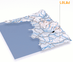 Places with similar names to Lolaj, Albania ::
Disclaimer :: Information on this page comes without warranty of any kind |
||
|
Where is Lolaj? Elevation and coordinates ::
Latitude (lat): 41°3'14"N Longitude (lon): 19°48'40"E
Elevation (approx.): 116m (map arrows pan, magnifying glasses zoom) |
||
|
Visiting Lolaj? Hotel/Accommodation ::
Book a hotel in Lolaj Travel Guide ::
Buy a travel guide for Albania rental cars ::
car rental offers GPS waypoint ::
download a GPX waypoint (PoI) of Lolaj for your GPS receiver
|
||