|
search place name
|
||
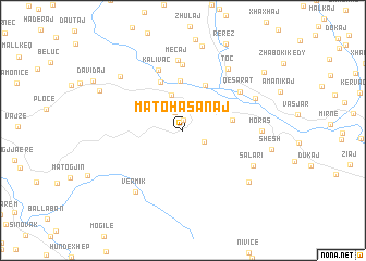
Matohasanaj (Gjirokastër, Albania)Matohasanaj is a town in the Gjirokastër region of Albania. An overview map of the region around Matohasanaj is displayed below.
regional and 3d topo map of Matohasanaj, Albania ::
Matohasanaj airports ::
The nearest airport is CFU - Kerkyra/corfu Ioannis Kapodistrias Intl, located 83.8 km south of Matohasanaj.
Other airports nearby include IOA - Ioannina (111.7 km south east), TIA - Tirana Rinas (118.1 km north), OHD - Ohrid (119.6 km north east), KSO - Kastoria Aristotelis (123.5 km east), Nearby towns ::
Sinanaj (1.1km north) //
Mamogjinaj (1.9km north) //
Dhëmblan (2.0km south east) //
Dorëz (3.7km north) //
Përparim (5.1km north) //
Lap-Martalloz (4.0km east) //
Anëvjosë (5.0km north) //
Leshnjë (5.2km north) //
Kalivaç (6.5km north) //
Bozanë (6.7km north) //
Qesarat (6.0km north east) //
Meçaj (7.2km north) //
Toç (7.3km north east) //
Vërmik (7.4km south west) //
Moras (6.2km east) //
Salari (6.6km south east) //
Iliras (6.6km north east) //
Shkozë (7.4km north west) //
Elez (7.4km south east) //
Lulëzim (8.7km north) //
Mazhar-Sevaster (7.7km north west) //
Rerëz (9.4km north) //
Koshtan (8.7km north east) //
[all distances 'as the bird flies' and approximate]  Places with similar names to Matohasanaj, Albania :: Disclaimer :: Information on this page comes without warranty of any kind |
||
|
Where is Matohasanaj? Elevation and coordinates ::
Latitude (lat): 40°21'16"N Longitude (lon): 19°49'58"E
Elevation (approx.): 432m (map arrows pan, magnifying glasses zoom) |
||
|
Visiting Matohasanaj? Hotel/Accommodation ::
Book a hotel in Matohasanaj Travel Guide ::
Buy a travel guide for Albania rental cars ::
car rental offers GPS waypoint ::
download a GPX waypoint (PoI) of Matohasanaj for your GPS receiver
|
||