|
search place name
|
||
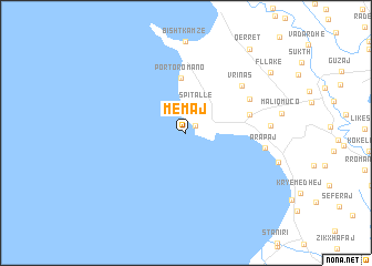
(( Memaj )) (Durrës, Albania)(( Memaj )) is a town in the Durrës region of Albania. An overview map of the region around (( Memaj )) is displayed below.
regional and 3d topo map of (( Memaj )), Albania ::
(( Memaj )) airports ::
The nearest airport is TIA - Tirana Rinas, located 26.4 km north east of (( Memaj )).
Other airports nearby include OHD - Ohrid (110.8 km east), TGD - Podgorica (116.8 km north), TIV - Tivat (134.5 km north west), BDS - Brindisi Casale (144.9 km south west), Nearby towns ::
Durrës (1.0km north east) //
Spitallë (2.9km north) //
Porto-Romano (5.6km north) //
(( Shpijat Kosovës )) (5.1km east) //
(( Shinavlash )) (5.9km north east) //
Vrinas (6.4km north east) //
Arapaj (6.2km east) //
Rrashbull (6.5km east) //
Fllakë (8.8km north east) //
Qerret (9.7km north east) //
[all distances 'as the bird flies' and approximate] 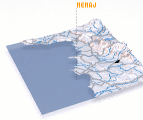 Places with similar names to (( Memaj )), Albania ::
Disclaimer :: Information on this page comes without warranty of any kind |
||
|
Where is (( Memaj ))? Elevation and coordinates ::
Latitude (lat): 41°19'0"N Longitude (lon): 19°26'0"E
Elevation (approx.): 67m (map arrows pan, magnifying glasses zoom) |
||
|
Visiting (( Memaj ))? Hotel/Accommodation ::
Book a hotel in (( Memaj )) Travel Guide ::
Buy a travel guide for Albania rental cars ::
car rental offers GPS waypoint ::
download a GPX waypoint (PoI) of (( Memaj )) for your GPS receiver
|
||