|
search place name
|
||
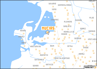
Muçias (Fier, Albania)Muçias is a town in the Fier region of Albania. An overview map of the region around Muçias is displayed below.
regional and 3d topo map of Muçias, Albania ::
Muçias airports ::
The nearest airport is TIA - Tirana Rinas, located 59.9 km north of Muçias.
Other airports nearby include OHD - Ohrid (107.9 km east), BDS - Brindisi Casale (134.9 km west), LCC - Lecce (137.9 km south west), CFU - Kerkyra/corfu Ioannis Kapodistrias Intl (147.9 km south), Nearby towns ::
Remas (1.3km south) //
(( Çakajas )) (2.0km south west) //
Gur (1.8km east) //
Kamenicë (2.3km north east) //
(( Babunjë e Vjetër )) (2.4km south east) //
Meç (2.8km north east) //
Karavasta (3.0km south west) //
Babunjë (3.3km south east) //
Kryekuq (3.8km north east) //
(( Babunjë e Re )) (3.5km south east) //
Zharnec (5.0km north east) //
(( Rungajë )) (4.7km south east) //
Havaleas (5.6km south) //
Kamenicë (4.5km north east) //
Agim (5.6km south) //
Runga (5.2km south east) //
Gungas (4.7km south east) //
Fier-Seman (4.9km east) //
Rusea (4.8km east) //
Semer (6.2km south) //
(( Gungas i Vjetër )) (5.7km south east) //
(( Gungas i Ri )) (5.7km south east) //
Shulenj (6.8km south) //
Ndërnënas (6.9km south west) //
(( Rusaman )) (7.3km south) //
(( Rustemaj )) (7.3km south) //
Mizë (7.3km north) //
Hasturkas (6.8km south west) //
Vanaj (7.1km south east) //
[all distances 'as the bird flies' and approximate] 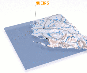 Places with similar names to Muçias, Albania ::
Disclaimer :: Information on this page comes without warranty of any kind |
||
|
Where is Muçias? Elevation and coordinates ::
Latitude (lat): 40°53'54"N Longitude (lon): 19°30'49"E
Elevation (approx.): 3m (map arrows pan, magnifying glasses zoom) |
||
|
Visiting Muçias? Hotel/Accommodation ::
Book a hotel in Muçias Travel Guide ::
Buy a travel guide for Albania rental cars ::
car rental offers GPS waypoint ::
download a GPX waypoint (PoI) of Muçias for your GPS receiver
|
||