|
search place name
|
||
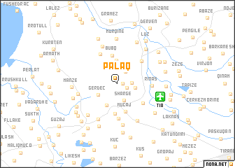
Palaq (Tiranë, Albania)Palaq is a town in the Tiranë region of Albania. An overview map of the region around Palaq is displayed below.
regional and 3d topo map of Palaq, Albania ::
Palaq airports ::
The nearest airport is TIA - Tirana Rinas, located 5.5 km east of Palaq.
Other airports nearby include OHD - Ohrid (95.0 km east), TGD - Podgorica (108.3 km north), TIV - Tivat (132.9 km north west), BDS - Brindisi Casale (167.7 km south west), Nearby towns ::
(( Gjeçaj-Kodër )) (0.6km east) //
Prezë (1.3km south east) //
Budulla (2.1km north east) //
Ahmetaq (1.7km east) //
Shargë (2.8km south) //
Fushë-Prezë (2.2km east) //
Gërdec (2.9km south west) //
Ajaz (3.7km north) //
Marqinet (3.6km south) //
Muçaj (4.5km south) //
Bubq (4.6km north) //
Vorë (4.7km south) //
Gjeçaj-Fushë (4.3km south east) //
Breg Shkozë (4.7km north east) //
Mazha e Madhe (5.1km north west) //
Kodër-Vorë (5.6km south) //
Rinas (4.2km east) //
Allçaush (6.1km south) //
Kameras (5.0km west) //
Mazha e Vogël (6.3km north) //
Picar (6.6km south) //
Bërxull (6.4km south) //
Karreç (6.1km south west) //
Hasan (6.5km north east) //
Murqinë (7.2km north) //
Manzë (5.5km west) //
Bilaj (7.1km north) //
Marikaj (7.1km south) //
Radë (5.8km south west) //
[all distances 'as the bird flies' and approximate] 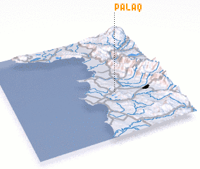 Places with similar names to Palaq, Albania ::
Disclaimer :: Information on this page comes without warranty of any kind |
||
|
Where is Palaq? Elevation and coordinates ::
Latitude (lat): 41°25'59"N Longitude (lon): 19°39'32"E
Elevation (approx.): 165m (map arrows pan, magnifying glasses zoom) |
||
|
Visiting Palaq? Hotel/Accommodation ::
Book a hotel in Palaq Travel Guide ::
Buy a travel guide for Albania rental cars ::
car rental offers GPS waypoint ::
download a GPX waypoint (PoI) of Palaq for your GPS receiver
|
||