|
search place name
|
||
Palikësht (Berat, Albania)Palikësht is a town in the Berat region of Albania. An overview map of the region around Palikësht is displayed below.
regional and 3d topo map of Palikësht, Albania ::

Palikësht airports ::
The nearest airport is TIA - Tirana Rinas, located 81.6 km north of Palikësht.
Other airports nearby include OHD - Ohrid (88.1 km north east), KSO - Kastoria Aristotelis (119.0 km east), CFU - Kerkyra/corfu Ioannis Kapodistrias Intl (121.3 km south), IOA - Ioannina (135.1 km south east), Nearby towns ::
Benollarët (1.1km south east) //
Gremshlinj (1.8km south) //
Velabisht (1.6km north east) //
(( Partizani )) (1.6km east) //
Mulitaj (2.2km north) //
Starovë (2.5km north) //
Ramanjat (2.8km south west) //
Gjeroven (3.0km south) //
Gjeroven (3.1km south) //
Çiflik (3.0km south east) //
Tulaj (3.5km south) //
Kamçisht (3.0km south west) //
Remanicë (3.8km north) //
Brakaj (4.0km north) //
Sadovicë (3.1km west) //
Berat (3.4km east) //
Korovesh (3.7km north west) //
Paftal (3.5km west) //
Veterrik (4.6km north) //
Prokop (3.9km south west) //
Galinë (3.8km west) //
Drobonik (4.0km south east) //
Mbreshtan (4.3km north west) //
Orizaj (5.3km north) //
Mbolan (5.3km south west) //
Lagjja e Shkallës (5.6km north) //
Dushnik (5.2km north east) //
Otllak (5.7km north) //
Lagjja e Re (6.4km north) //
[all distances 'as the bird flies' and approximate] 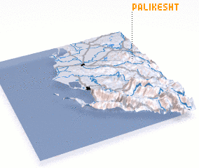 Places with similar names to Palikësht, Albania :: Disclaimer :: Information on this page comes without warranty of any kind |
||
|
Where is Palikësht? Elevation and coordinates ::
Latitude (lat): 40°41'41"N Longitude (lon): 19°54'55"E
Elevation (approx.): 152m (map arrows pan, magnifying glasses zoom) |
||
|
Visiting Palikësht? Hotel/Accommodation ::
Book a hotel in Palikësht Travel Guide ::
Buy a travel guide for Albania rental cars ::
car rental offers GPS waypoint ::
download a GPX waypoint (PoI) of Palikësht for your GPS receiver
|
||