|
search place name
|
||
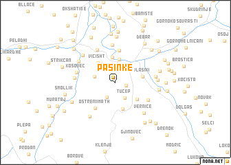
Pasinkë (Dibër, Albania)Pasinkë is a town in the Dibër region of Albania. An overview map of the region around Pasinkë is displayed below.
regional and 3d topo map of Pasinkë, Albania ::
Pasinkë airports ::
The nearest airport is OHD - Ohrid, located 38.6 km south east of Pasinkë.
Other airports nearby include TIA - Tirana Rinas (64.2 km west), SKP - Skopje (109.3 km north east), PRN - Pristina (130.9 km north), KSO - Kastoria Aristotelis (131.8 km south east), Nearby towns ::
Lladomericë (1.4km east) //
Tërbaç (2.4km north west) //
Radovesh (2.6km south west) //
Tuçep (2.8km south east) //
Golovisht (3.0km north west) //
Izvir (2.7km west) //
Trnanić (3.8km north) //
Bomovo (4.1km north) //
Viçisht (3.9km north west) //
Otišani (3.8km south east) //
Ostreni i Vogël (4.4km south) //
Vlasiki (3.4km east) //
Sušica (5.2km north) //
Ostreni i Math (4.9km south west) //
Džepište (4.9km south east) //
Kestenjar (5.7km north) //
Konjari (6.1km north) //
Kosovec (5.0km west) //
Golem Papradnik (5.0km east) //
Lubalesh (5.0km west) //
Mal Papradnik (5.1km east) //
Vernicë (6.1km south east) //
Mallakastër (5.6km north west) //
Çerenec i Epërm (6.0km north west) //
Orzhanovë (6.3km south west) //
Pralenik (5.4km east) //
Balanci (5.7km east) //
Selokuki (7.5km north) //
Kojavec (6.2km south west) //
[all distances 'as the bird flies' and approximate] 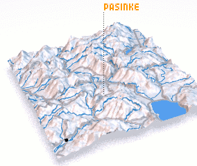 Places with similar names to Pasinkë, Albania ::
Disclaimer :: Information on this page comes without warranty of any kind |
||
|
Where is Pasinkë? Elevation and coordinates ::
Latitude (lat): 41°28'6"N Longitude (lon): 20°29'7"E
Elevation (approx.): 607m (map arrows pan, magnifying glasses zoom) |
||
|
Visiting Pasinkë? Hotel/Accommodation ::
Book a hotel in Pasinkë Travel Guide ::
Buy a travel guide for Albania rental cars ::
car rental offers GPS waypoint ::
download a GPX waypoint (PoI) of Pasinkë for your GPS receiver
|
||